Tropical Cyclones 'Lam' And 'Linda' To Come Visiting Australia Together In Early January 2015?

Update: December 31, 2014

Come 2015 and Australia is likely to have unwelcome visitors. May be a tropical cyclone or two in early January.

The seas along the northern Australia coast are in ferment. Major reliable forecast models available with XWF-WEATHER strongly hint at the possibility of a tropical cyclone developing in Timor Sea, Arafura Sea or in both. The suspect area where a cyclone may develop is the coast along the towns of Berby and Broome in North-West Australia.

Most forecast models agree that a low pressure area and then a cyclone will develop in that area. The 'low' will develop on January 5-6, 2015, which will subsequently intensify into a tropical cyclone. There is disagreement on the likely path and intensity of the probable cyclone. 

One possibility is the storm develops near the coast of Broome-Derby on January 10 and moves inland right away. This will bring rainfall  to The Great Sandy Desert and Gibson Desert. This option envisages a weak storm but a great rain-maker.

The second scenario is a storm develops on January 8 and intensifies into something nasty (Minimum Central Pressure of 987 Mb) and moves along the coast of western Australia.

There are chances of another tropical cyclone developing in the Arafura Sea or Gulf of Carpentaria on January 6, 2015 and making landfall in the coast along the Gulf. This storm is likely to affect Wessel Islands, Groote Island, Sir Edward Pellew Group and Wellesley Islands (And of course the town of Karumba). All in Queensland. This storm may also cross over into the Coral Sea and intensify rapidly and threaten the eastern coast of Queensland.

The time period between January 5 to January 15, 2015 is pregnant with possibilities of cyclones developing that will affect Australia. Are tropical cyclones 'Lam' and 'Linda' visiting Australia together soon?

The bad news is that may be the drought of cyclones since 2011 when severe tropical cyclone Yasi hit Queensland is about to end in the coming days.

Cyclone 'Yasi' was the last cyclone to hit Australia in February 2011.
Share this PostPin ThisShare on TumblrShare on Google PlusEmail This

December 31, 2014: XWF-WEATHER Forecast Summary

Storm 95B in the Bay of Bengal is in its death throes. Within the next 36 hours it will dissipate. But weather will be overcast and windy in coastal Odisha, West Bengal and Bangladesh till then. Some showers expected in these areas.

Tropical Storm Jangmi has weakened into a depression as it heads to Palawan. For the next few days it will move towards southern Thailand (And northern Malaysia) and bring rains there. Just that. Rains.

Australia is staring at a big cyclone in early January, 2015. North and Western coasts of the country. Cyclone Lam is imminent.

In south west Indian Ocean two tropical cyclones seem likely. First will affect southern Madagascar. The second will hit Mauritius and La Reunion around January 12, 2015.
Share this PostPin ThisShare on TumblrShare on Google PlusEmail This

December 30, 2014: Today's Forecasts In A Nut-Shell

LATEST XWF-WEATHER FORECASTS: A SUMMARY

Depression 95B has proved to have more stamina than expected. It is braving the cold waters as it ascends the latitudes in the Bay of Bengal. Likely to dissipate by January 2, 2015. Rains expected in east coast of India and Bangladesh.

Jangmi will not intensify much but will reach Thailand as a rain-maker. 

Kate goes strong as a category 3 hurricane tearing down the S Indian Ocean. Will start weakening soon.

North West Australia faces Cyclone Lam on January 6, 2015. Even Perth will be affected.

The Mascarene Islands (Mauritius, Reunion) will have a depression first (Or a cyclone) than may be a big cyclone on January 15-16, 2015.
Share this PostPin ThisShare on TumblrShare on Google PlusEmail This

A Vigorous Southern Indian Ocean May Throw Out A Couple Of Big Cyclones In Next 15 Days: Lam Coming To Australia

Update: December 30, 2014

Mother Earth May be hurtling blizzards and Arctic blasts in North Asia, Europe and North America but when it comes to the tropics, the Southern Indian Ocean reigns supreme. This active ocean already has a category 3 hurricane 'Kate' hurtling down south. In the next fifteen days it may engender two more tropical cyclones. Especially tropical cyclone 'Lam' which is expected to hit the western coast of Australia in early January, 2015.

Even as Kate will be in her death throes on January 2, 2015, another storm will come into being in the Mozambique Channel. This storm already exists as a low hugging the Afrian coast. In the next two days it will start intensifying and move around southern Madagascar. This storm may remain a deep depression, possibly a borderline cyclone.  Though this will not move north towards the Mascareignes, another depression (A potential cyclone) will come visiting the area on January 7, 2015. This depression now lies as a 'low' some hundred kilometers SW of Diego Garcia presently.

What is more interesting is the possibility of a big bad cyclone hitting western Australia in early January. Cyclone Lam will form on January 6, 2015 off the coast of North-West Australia between Broome and Karratha. Lam is going to be a big storm. Central pressure of 973 Mb. Exmouth will be badly hit with winds of 150 kph. The storm will not make landfall but move along the west coast of the country. Geraldton and Perth will too be affected.

That is not all. On January 12 a low pressure area will form north of Mauritius and will then start intensifying rapidly. Mauritius and La Reunion can expect a big cyclone on January 15-16.

Share this PostPin ThisShare on TumblrShare on Google PlusEmail This

Post Kate, South Indian Ocean May Spawn Two (Three?) Cyclones: North West Australia To Face "Lam".

Update: December 29, 2014


The South Indian Ocean is gonna give birth to two more tropical cyclones, Bansi and Lam in the coming days, post-Kate. Australia may face its first cyclone this season. There is also some indication that another cyclone might come visiting to the Mascareignes in mid-January.

The ocean is most vigorous right now. The mighty Pacific could only throw up a weak Jangmi, in contrast the Indian Ocean is throwing out fistful of storms. Even the northern Indian Ocean gave rise to a depression 95B in mid winter. The Southern part has a energetic Cyclone Kate moving down south whipping up sustained winds of 125 kph.

The ocean has more in store for us. Two more cyclones in the coming week. Bansi and Lam. Targets? Madagascar and North-West Australia.

Cyclone Bansi will come first. It will be born as a low pressure in the Mozambique Channel, the strip of Indian Ocean between the African mainland and the island of Madagascar. It will born in the next 24 hours. It will remian an innocuous low pressure for some time  like any of the numerous "L" that bob around the ocean. But come January 4, 2015 and it will start intensifying. It will then move round southern Madagascar (An intelligent storm???) and enter South West Indian Ocean proper. And intensify into Tropical Cyclone Bansi by January 8. Bansi will be a storm with a central pressure of 994 Mb, something like Kate. It is not expected to move north towards Reunion or Mauritius but move south into the powerful westerlies.

Cyclone Lam  This will be born off the coast of North-West Australia (Near Broome) on January 4, 2015. It will then toddle around in that part of south east Indian ocean, intensifying all the while. Lam is gonna be bigger than Bansi. Central Pressure of 989 Mb. This storm is going to make landfall near the Australian town of Exmouth and Barrow Island on January 10, 2014.

It is still early days. So one can hardly be certain of the intensity and path the upcoming cyclone is gonna take.

Parting Tidbit

Around January 14, 2015, Mauritius and La Reunion may have a tropical cyclone as an unwanted guest. If early model forecasts available with XWF-WEATHER are to be believed this is going to be a nasty storm which will come over from northern Madagascar. May be 'Chedza' will follow 'Bansi' soon this January.
Share this PostPin ThisShare on TumblrShare on Google PlusEmail This

Tropical Storm JANGMI Will Be A Little Storm: But Heavy Rains In Philippines. Vietnam Not To Be Affected

Update: December 29, 2014

Tropical Storm Jangmi will be a little storm. At its zenith it will whip up winds of 75 kph. No More. But it will bring a lot of rain to central Philippines till January 1, 2014.

Right now the storm has entered central Philippines. Heavy rains are lashing Caraga in Mindanao. The storm will move through Visayas (All of them) and exit the country via Palawan. It is going to intensify when it leaves the Western Viasayas tomorrow evening (Local Time). Winds will reach speeds of 75-80 kph. So Palawan is in for a windy, wet New Year's Day.

Jangmi is not expected to hit Vietnam. It is going to move in a SW direction after leaving Palawan. It will then move in the South China Sea and dissipate before it reaches Thai shores on January 4, 2014. Some rains in Thailand too on that day.

Track Path Forecast for Tropical Storm Jangmi according to JTWC (Bulletin issued at 0300 hours, GMT, December 29, 2014)


See TS Jangmi Live
Share this PostPin ThisShare on TumblrShare on Google PlusEmail This

Bay of Bengal Depression 95B: Will Peter Out In Three Days, But Heavy Rains In Coastal Andhra, Odisha.

Update: December 29, 2014

As expected depression 95B that is hovering around in the south-west Bay of Bengal will not intensify into a cyclonic storm. It will potter around in the sea and dissipate in the next 72 hours.

The winter is inconducive to 95B to intensify any further. It is at presently sniffing around looking for avenues that will help it grow. But the waters up north in the Bay are colder hence it will just move around in the Bay and then dissipate.

Contrary to what the GFS forecast believes 95B will move north along the coast and even throw up cyclone speed winds on January 1, 2014 when it will be near the Odisha coast. The storm will move much closer to the Indian coastline then was earlier expected. So more rains expected, especially in coastal Andhra and Odisha.

About the rainfall it will cause. Not much. At least less than expected. 95B is going to dump most of its precipitation in the sea itself as it is not going to make landfall. But even then it has a lot of energy and so it will throw rain-bearing clouds onto coastal India. Odisha will receive heavy rains in a day or two. Rainfall and winds expected in coastal Tamil Nadu, Andhra, West Bengal and even Bangladesh till January 2, 2014.

See Depression 95B LIVE

See the detailed Rainfall Forecast Maps for more information and forecast.

Infra-Red satellite image of 95B taken at 0530 Hours IST, December 29, 2014.


The Track Path Forecast for 95B. The red line is the GFS forecast. The storm will dissipate in the sea near the Andhra coast on January 1, 2015.
Share this PostPin ThisShare on TumblrShare on Google PlusEmail This

Depression 99W Heading To Philippines: May Turn Into A Tropical Storm: Heavy Rains Heading To Vietnam Too.

Update: December 27, 2014

India is not the only country that's staring at a depression. Depression 99W is heading Philippines' way. It is likely to reach it in the next 48 hours.

Heavy rains and flooding is what the Philippines is going to experience as the tropical depression 99W heads for it. The storm is going to affect central Philippines the most. The Visayas the most. Unfortunate Tacloban is in for heavy rains and some gusts in the next two days.

The depression will move through Philippines and emerge into warm waters of the South China Sea on December 31, 2014. That is when it is expected to intensify into Tropical Storm 'Jangmi'. It will then move towards southern Vietnam weakening before landfall on January 2, 2015. 

Jangmi will be a small cyclone with a central pressure of 997. It will be at its strongest as it moves across the South China Sea. Winds will not be the major problem for Vietnam as the heavy rains. Expect a deluge in the southern part of the country in early January.

See Rain Forecast Maps


Share this PostPin ThisShare on TumblrShare on Google PlusEmail This

Storm 95B: Bay Of Bengal: No Cyclone, Just A Depression, But A Big Rain-Maker

The Storm 95B which is presently hovering in the Bay of Bengal near the coast of Sri Lanka is unlikely to intensify into a cyclone.

Update: December 27, 2014


Earlier there were expectations that the system would strengthen briefly into a cyclone. But latest forecasts rule out the possibility. The storm will remain a depression but owing to its inner stamina it would move north into the Bay of Bengal. It is likely to dissipate on January 4, 2015, before it makes landfall into Bangladesh.

In the next two days it will drift close to North Sri Lanka (More rains!) and the coast of Tamil Nadu (Rains! Rains!) then move away from the coast and move north. The colder waters of the north Bay of Bengal will not prove conducive for it and and the depression will start weakening (If it had been June or September, it would have turned into a roaring cyclone!).

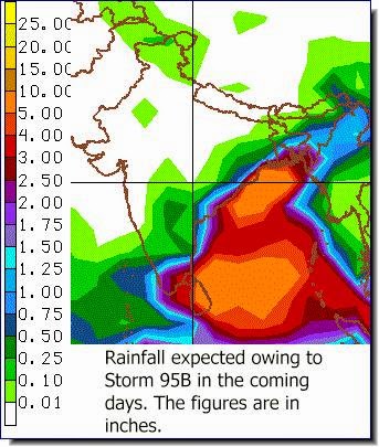
But it is a depression and so will throw up some winds (30-50 kph) in North Sri Lanka and Tamil Nadu. And of course, the rains. For the expected rainfall from this depression see the Rainfall Forecast Map below.


We can see from the forecast map (The figures are in inches) that depression 95B is going to bring very heavy rainfall (25 inches) to coastal Andhra Pradesh. Also heavy rains (5-10 inches) are expected in northern Sri Lanka, coastal Tamil Nadu (Including Chennai), Andhra Pradesh, Odisha and West Bengal. Rains are also likely in coastal Bangladesh by January 4, 2015.

See detailed Rainfall Forecast Maps

CMC Model Predicts A Cyclone!

The esteemed Canadian Model still remains bullish on the depression. It expects the storm to intensify into big cyclone and hit Bangladesh on January 1, 2015. Something like the energetic cyclone Kate which is ripping across the waters of south Indian Ocean as we speak.

But we take this prediction with a big pinch of salt. The possibility of a big bad storm emerging from 95B seems remote.

The same model predicts two cyclones forming in the south Indian Ocean in the next one week. One hits Rodrigues Island (Mascarene Islands) on January 4, 2015. (Surprisingly even the NAVGEM Model supports this prediction) And another hitting north-west Australia on the same day.

Seems unlikely.
Share this PostPin ThisShare on TumblrShare on Google PlusEmail This

Bay Of Bengal Storm: December 2014: Perhaps A Cyclone Is Coming.

Update: December 26, 2014

Seems like a cyclone is imminent in the Bay of Bengal. Earlier forecasts by leading weather models had said the system would at best be a deep depression. We too were sceptical about a cyclone brewing in the Bay of Bengal in mid winter. But latest forecasts say other wise. May be we are staring at the possibility of a tropical cyclone in the next 72 hours. Climate change? Perhaps.

It is generally agreed by reliable forecast models that the system 95B that hovers presently near Sri Lanka will intensify on December 29-30 into a tropical cyclone. In the next few days the storm is going to go around in a circle. Go south first then curve east, then north then westwards towards the coast of Tamil Nadu. At that point on December 30, 2014, it will intensify into a cyclone. The central minimum pressure (Which is an indicator of how strong a storm is: Hurricane Wilma had a central pressure of 882 mb) will drop into the 990s from the 1002-1004 mb levels.

After that opinions differ. The GFS says it will  travel a few hundred kilometers from the Indian east coast and head to Bangladesh. The European model agrees more or less, only it says it will be a weaker storm. The US Navy's NAVGEM Model is the most bullish on 95B. It gives a central pressure of 993 and the strongest wind speeds. It says the cyclone will move in the Bay of Bengal and hit Andhra coast on December 31, 2014.

It seems Mother Earth wants to start the new year with a bang.

Whatever happens the expected tropical storm is not going to be in the league of Phailin, Hudhud or even Nilofar. One can hardly expect a super cyclone in the Bay of Bengal in December. But it might throw out winds of around 80 kph or more. And of course it is going to be a rain-maker. Depends on how it goes. Sri Lanka is getting a deluge right now because of 95B.

In conclusion, we feel system 95B will turn into a tropical cyclone in the next three days, when it is near the coast of Tamil Nadu, but it will start weakening as it ascends the latitudes and experiences the colder waters of the Bay. The moot point is will the IMD christen the storm when it is at its strongest on December 29-30 or will 95B remain an unnamed "deep depression"?

A latest satellite image of 95B taken at 0500 hours GMT, December 26, 2014. (Image Courtesy: NOAA)

The latest track path forecast of Storm 95B. The yellow line is the path prediction by the Canadian GEM Model. The other two are the forecasts by GFS and US Navy's NAVGEM Models.

This chart predicts the intensity of Storm 95B. The forecast is by AVNO, an offshoot of the GFS Model. The expected wind speeds are given in Knots. I knot = 1.85 kilometers per hour (Kph). The chart says the system will turn into a cyclone after 72 hours when its winds will exceed 64 kph.

The IMD remains bearish on chances of a cyclone. It seems we will have to be satisfied with a "deep depression".

Rainfall Prediction Map: How much rain is Storm 95B (Ashobaa?) going to bring and where in the next 8 days?
Share this PostPin ThisShare on TumblrShare on Google PlusEmail This

Philippines In Peril: Tropical Storm Jangmi Is Coming!


Philippines has just emerged from typhoon Hagupit, when another peril lurks round the corner. Jangmi is gonna come visiting the country on December 29.

Tropical Storm Jangmi is gonna be a slimy customer. Right now it does not exist, even as a low pressure. Hence it has not come on NOAA's constant vigil, even as an "invest".

The storm will begin innocuously as a low north of Papua New Guinea in a day or two. It will then stealthily creep towards Philippines, come near the coast of Mandanao, then intensify rapidly into a tropical storm, very close to the coast of the country on December 29, 2014.

It will then move NNW and enter the country from the Eastern Visayas.

Jangmi will be no Hagupit but it will cause trouble because it will be a slow moving storm. It is gong to move diagonally into the country. Hence lots of rains and of course the winds.
Share this PostPin ThisShare on TumblrShare on Google PlusEmail This

Storm Forms Off Sri Lankan Coast: Cyclone Ashobaa?

A low pressure has formed 200 kilometers SSE from the Sri Lankan coast (4.6 N Latitude, 82.6 E Longitude) that has NOAA raising its ears and start tracking it. NOAA calls it 95B. The stretch of south Bay of Bengal from Sri Lanka to the Indian Andaman Islands has been very turbulent since the last few days. There have been frequent downpours in Sri Lanka leading to floods.

Now the turbulent weather is crystallizing into a storm. Earlier we had predicted a depression, but now it seems a cyclone is in the offing. A very large diameter cyclone. Not very windy as compared to the formidable Phailin and Hudhud but a big trouble-maker.

Yeah. Chances are this storm that hovers south of Sri Lanka is going to metamorphose into cyclone Ashobaa. The eye of the storm will become visible on December 28, 2014. And sustained winds will cross the threshold of 64 kph (To be termed a cyclone). But one doubts whether the Indian Met Department will christen it "Ashobaa". One has observed that the esteemed met dept, unlike the Americans and Australians, is very reluctant in christening storms. They prefer the term deep depression which need not be named.

We feel the current storm is going to qualify enough to be 'promoted' to a cyclone. But the venerable IMD has the powers....

Anyway... The cyclone is expected to move north along the coast of India and reach Bangladesh on January 2, 2015. So expect windy and wet weather along the coastal areas of Tamil Nadu, Andhra, Odisha and West Bengal. Sri Lanka, of course, is in for more precipitation in the coming days.

The heaviest rains will be coastal Odisha, West Bengal and Bangladesh.

But we should keep one thing in mind. This is not June or September-October. This is mid-winter. The end of the month of December. So the waters of the Bay of Bengal are going to colder as we ascend the latitudes. So the cyclone, if it forms, is going to be strongest when it will be in the warm waters of Sri Lanka and Tamil Nadu. As it moves further north it will start weakening. The storm will be strongest on December 29, 2014. Then the decline will start.

We feel it will be best, a deep depression, A big rain-maker, but no cyclone.

We shall continuously monitor the upcoming storm and give you the latest updates.

See the Bay of Bengal (December 2014) depression LIVE.

See Rain Forecast Maps For South Asia for the rainfall owing to the upcoming depression.


Live animated water vapor satellite images of Storm 95B in the Bay of Bengal

The forecast track path of 95B in the Bay of Bengal
Share this PostPin ThisShare on TumblrShare on Google PlusEmail This

Cyclone Kate Forms In South Indian Ocean


Update: December 25, 2014

In a twist of bureaucratic technicality Cempaka became Kate. Since the cyclone formed lower than 10 degrees south latitude the Australian Met got the honors of christening the storm and not Indonesia.

We had been predicting the arrival of cyclone Kate for the last few days. At 0000 hours GMT today it lay at 11.4 degrees south and 97.2 degrees east with wind speed of 65 kph; The cut-off to be named a cyclone.

For the next two days Kate is just going to toddle around the waters of the South Indian Ocean remaining at the same strength, not weakening, not strengthening. Come December 27, 2014 and Kate will swing into action. She will start intensifying rapidly. She may reach wind speeds of 100 kph and move south.

But Cyclone Kate is going to be short-lived. On December 29, the storm will experience the strong westerlies which will literally tear it apart.

The Cyclone Kate Forecast Track Path issued by the JTWC at 0300 hours GMT today
Share this PostPin ThisShare on TumblrShare on Google PlusEmail This

Cyclone CEMPAKA To Form Off Indonesia.Cyclone NUTE Forming In South Pacific. Depression Heading To Indian East Coast.

Update: December 23, 2014

The oceans are getting restive again, eager to restore the balance (That is why storms form; to restore atmospheric balance). Tropical Cyclone Cempaka is likely to form on December 26, 2014. The South Pacific will throw up a storm. Cyclone Nute is forming right now, north of Vanuatu Island. And a depression will form near the Indian Andaman Islands and move to the Indian east coast.

Let us start with Cyclone Nute. The storm is a low pressure now and lay at 14.1 Degrees South and 159.9 Degrees West with winds of 35 kph. It presently lies about 1000 kms east of American Samoa Island. It is already intensifying and is likely to become a tropical cyclone in the next 24 hours and move in a SW direction. The only inhabited islands to be affected are French Polynesia and Cook Island.

By the way, the same area in the South Pacific is going to spew another storm (Cyclone Odile) in another 2-3 days. This storm will hit the American Samoa Islands.

Now for cyclone Cempaka. It will be born south of the area where the short-lived Bakung was born; Off the coast of Java. It lies as an "invest" (An area of disturbances where a meteorologist thinks a storm will develop) at 9.7 degrees South, and 100.4 degrees East. Come December 26, 2014 and it may develop into cyclone Cempaka. Now this storm is going to go straight into the Indian Ocean. No inhabited islands are around so only the sipping lanes will be affected. The storm will dissipate on December 29.

Deep Depression In Bay Of Bengal

And now the rain-maker depression which is going to drench the Indian east coast. The storm will form near the Central Andaman Islands and head west on December 24, 2014, that is tomorrow. It will reach Sri Lanka and Tamil Nadu on December 28, 2014. When it nears the land masses it will swerve away and move along the Indian coast in the Bay of Bengal in the next 2-3 days. So rains are expected along the entire Indian east coast. That includes the states of Tamil Nadu, Andhra Pradesh, Odisha, West Bengal. It is going to bring rains even to Bangladesh. So expect rains in all these areas by the end of the month (And year). Only the coastal areas will receive the rains.

There is a possibility that this depression might reach cyclone status when it coasts pass Tamil Nadu.

Another Typhoon In Philippines?

There is good chance that another typhoon is heading Philippines' way. A storm is brewing in the Pacific, a few hundred kilometres east of Philippines now. It will move west and is likely to make landfall in southern part of the country on December 27' 2014. We feel it might not reach tropical cyclone strength and will remain a deep depression. Lots of rains and very windy in Mindanao on December 27-28. Or will turn into typhoon Jangmi?

Share this PostPin ThisShare on TumblrShare on Google PlusEmail This

In The Next 15 Days.....A Cyclone Forming In South Pacific

Update, December 22, 2014.

  • A typhoon may hit central Philippines on December 27, 2014 in the Visayas.
  • A cyclone may form in the South Indian Ocean on December 26, 2014. No land areas will be affected.
  • A depression has formed in the south Pacific Ocean near Vanuatu, east of the Australian coast. It is expected to intensify into a cyclone in the next 24 hours. It,s present winds are 35 kph. The storm will move SSE.
  • Water vapor satellite image
Share this PostPin ThisShare on TumblrShare on Google PlusEmail This

Within 15 Days...Cyclone Develops South Indian Ocean. Depression Hits Srilanka

December 20, 2014 Update

  • A cyclone may develop a few hundred kilometers NE of Rodrigues island on December 25, 2014. It will reach speeds of 75-90 kph. Not expected to hit the island but pass it by.
  • A deep depression will hit Srilanka around December 27, 2014. Strong winds and heavy rains expected.
  • A depression near Madagascar will bring rains to Reunion and Mauritius around December 31, 2014.
Share this PostPin ThisShare on TumblrShare on Google PlusEmail This

Image of the day: December 19, 2014: North India and the Himalayas


Share this PostPin ThisShare on TumblrShare on Google PlusEmail This

Bakung Is Dead!

Update: December 17, 2014

Bakung is dead. The GFS had painted a rosy picture for the storm yesterday which had encouraged us to write about it hitting Mauritius. 

But there are changing factors in the Indian Ocean which has even the top forecast models giving radically different forecasts at every successive bulletins. The ocean is in deep ferment right now. No doubt about it. What worries us that with such rapidly changing conditions the hazard of a cyclone developing rapidly and moving even more rapidly becomes more.

We took a lot of flak for predicting that Bakung would hit Mauritius yesterday. Some folks even suggested that we could not read weather charts properly! What should be understood is that we base our predictions on what the various forecast models say. And when variables change rapidly, as they are doing so in the Indian Ocean, one get wildly fluctuating forecasts.

Please, do not shoot the messenger. Our only fault is that we do not wait (Like various Met Departments do) cautiously till a storm has formed and then give out weather forecasts. We do not play safe. We give you what the latest computer models say. Even if we get eggs thrown on our faces.

We inform and give out possibilities. First. As also the latest updates. And we shall continue to do so.

Keep in touch for the latest.

Update: December 16, 2014

The Mascareignes are in for tough times if latest forecast models are to be believed. The trouble
will come with the name of Bakung. The storm is going to start intensifying after 96 hours and start moving tpwards the Mascarene Islands. It will still be strengthening when it hits Mauritius head-on around the end of the month.

The presently weakened Bakung is not a cyclone now. Just one of the low pressure areas bobbing around in the vast Indian Ocean. But this is no ordinary low pressure area. It is going to cause serious trouble for Mauritius by the end of the month.

We have saying in the last few days that the Indian Ocean is in ferment now. We had also predicted that Bakung was down but not out.

The storm is going to slowly start intensifying after 96 hours. That is around December 21, 2014. After that it will start heading towards the Mascarene Islands. By the time it hits Mauritius on December 29, 2014 it will be a powerful cyclone. The central pressure of the storm will be 983 mb. A respectable storm. Not a Hagupit. But still a big enough storm to cause damage. The winds will be 150 kph when it hits Mauritius.
Share this PostPin ThisShare on TumblrShare on Google PlusEmail This

December 19, 2014: In The Next 15 Days......Storm To Hit Sri Lanka On Christmas Day

December 19, 2014


  • A deep depression (Or a cyclone) may hit Sri Lanka on December 25, 2014. The system will form on December 20 near the coast of Thailand and move through the Andaman and Nicobar Islands the next day. It will reach the Sri Lankan coast on December 25. Very heavy rains and winds of around 60 kph expected.


December 16, 2014
  • The Southern Indian Ocean is very disturbed. One sees many low pressure areas bobbing around. Depression Bakung is expected to intensify on December 20, 2014 into a 120 kph storm, and move towards Rodrigues Island.
  • The GEM Forecast models predict another storm following on the heels of Bakung. That too heading for Rodrigues Island. The island faces a cyclone threat in the coming 10 days.
  • Northern Sri Lanka and southern Tamil Nadu (India) may be hit by a string of depressions between December 25 and December 31, 2014. Three at the latest count.
  • Vietnam can expect a tropical storm in early January, 2015.
  • Andaman and Nicobar Islands (India) can expect a very wet month end.
  • Northern mountainous regions of India (Kashmir, Himachal and Uttarakhand) will receive up to 15 feet of snowfall till Christmas Day.
  • Heavy snowfall in the areas around Great Lakes (US and Canada) in the coming 48 hours.
  • Winter storm will bring snowfall to Scotland in the coming days. Heavy snowfall in the Alps in the next week.
  • Another storm approaching the US North West.
Share this PostPin ThisShare on TumblrShare on Google PlusEmail This

December 15, 2014: In Next 15 Days... Perhaps...:

In this new column we make predictions on what may happen in the next 15 days. 15 days weather prediction is fraught with uncertainties. But we outline the possibilities....

  • A deep depression in the Bay of Bengal may hit the Indian state of Tamil Nadu around December 30, 2014. Very heavy rains possible.
  • A strong typhoon may develop west of the Philippines coast in the South China Sea on December 26, 2014. Destination? Wait for next issue.
  • The present depression "Bakung" in the south Indian Ocean will intensify into a cyclone and hit Rodrigues Island on Christmas Day
Share this PostPin ThisShare on TumblrShare on Google PlusEmail This

Image Of The Day: December 14, 2014: Snowfall Over Kashmir and North India


Share this PostPin ThisShare on TumblrShare on Google PlusEmail This

Bakung Will Come To Mascareignes As A Depression

Update: December 15, 2014

The chances of Bakung turning into a significant storm is getting remote.. The earlier forecasts hinting at a Category 2 hurricane seem to be receding.

Bakung is a mere Tropical Depression now. It has moved east in the last few days. It lies about 1000 kms ESE of Diego Garcia.

Most models agree that it is not going to move south as earlier predicted but move SW towards the Mascarene Islands. It is likely it will reach these islands as a depression by the end of the month. The GEM Model differs from the others. It foresees Bakung rejuvenating and A NEW storm being born in the coming week. And this storm (and not Bakung) will hit the Mascarene Islands around December 25, 2014. The model furthers says it will be a cyclone, not a mere depression.

Things are confused now. We have to wait for a few days till the "fog" clears.

Cyclone Bakung as seen on December 12, 2014
Share this PostPin ThisShare on TumblrShare on Google PlusEmail This

BAKUNG Down But Not Out


Update: December 14, 2014

Owing to adverse conditions cyclone Bakung has weakened to a depression. The JTWC has stopped writing about it. But within 36 hours it is going to regenerate and rise like a Phoenix.

Most forecasts give it a moderate future. One goes onto say it will turn into a Category 2 hurricane. Most say it will be  Cat. 1 storm. Bakung will intensify rapidly in a day or two and then start moving south.

It is most likely that the invigorated Bakung will not affect the Mascarene Islands. But the ECMWF model says otherwise. It foretells a strong cyclone (Minimum Central Pressure of about 980 mb) moving straight to these islands.

One of the forecasts paints a dramatic picture. That another cyclone will form in the South Indian Ocean that will merge with Bakung. The result will be a bigger storm. But these are mere different calculations for now.

One thing is certain. Cyclone Bakung is going to come back in 48 hours.
Share this PostPin ThisShare on TumblrShare on Google PlusEmail This

Cyclone Bakung Will Turn Out To Be A Category 2 Hurricane


Update: December 13, 2014

Cyclone Bakung which is at present hovering in the south Indian Ocean will intensify into a 140+ kph storm. Where will it go? What will be its path, track?

It lies 1200 kms ESE of Diego Garcia now (0430 Hours GMT). Winds are 75 kph. In the coming days it will intensify gradually to a storm with sustained winds of 150+ kph. Though there is a likelihood that it might go north and rather than start moving south straight away. Most probably it will steam down south in the Indian ocean without any land mass, in the stretch between Africa and Australia.

But forecasts differ. The European model predicts it will not strengthen in to something big but remain a weak storm but its direction will be different. A SW direction. Meaning it will head to Mascareignes.

Bakung will potter around its present area for a few days then on December 16, it will intensify rapidly into a 150 kph cyclone.

The chances of it hitting Mauritius is remote now. Only the Europeans support this track. The Americans predict a stronger storm which will go straight south and embrace the Westerlies and perish around December 22-23.
Share this PostPin ThisShare on TumblrShare on Google PlusEmail This

BAKUNG: Track Forecast


The latest forecast GFS predicts (Like the ECMWF) that the storm will inch closer to Mascareignes.


Tropical Cyclone BAKUNG: JTWC Track. 2100 HRS GMT, Dec. 12, 2014


Track Forecast For 90S: GFS and NAVGEM
JTWC Bulletin For WXTS21, 0230 HRS GMT, 2014


Share this PostPin ThisShare on TumblrShare on Google PlusEmail This

Cyclone BAKUNG Has Formed Off Sumatra In Southern Indian Ocean

Update: December 12, 2014: CYCLONE BAKUNG IS INTENSIFYING NOW

Bansi is Bakung. The cyclone was born in Indonesia's area of meteorological influence, hence it go the honors to do the christening. But it is likely that this cyclone will recognise no bureaucratic areas of influence and may head to Mascareignes after a long long journey (ala Hagupit which traveled for 12 days). Right now cyclone Bakung is intensifying in the warm waters of the Indian Ocean. By December 15 it will be a 100+ kph storm.

Its future is uncertain. It may head straight south to commit suicide fighting the mighty Westerlies. Or it might take a SW course and reach the Mascareignes after a long journey. Some say it will be a big storm, central pressure of 979. Others say it will trudge along as a depression. Most track forecasts only go uptil 5 days. Bakung seems to have everybody confused and divided.

See "Bakung" Track Forecast

The forecasts differ because they have different estimates of wind shear that Bakung is going to face. The GFS forecasts a high shear so it says the storm will not go far or will not intensify much. The other models give it a more favourable conditions, so it will flourish and go far.

For folks in the Mascareignes, where the local met departments follow the European Forecast Model, there is bad news. The ECMWF (The European Model) predicts Bakung is going to come hunting in your waters as a big bad storm. Especially vulnerable is Rodrigues Island whom Cyclone Bakung might affect after December 23, 2014.

It is a storm to watch. It is going to travel a long distance.

Update: December 10, 2014

Future storm Bansi is very much on. NOAA has started monitoring the system labeled "90S". Presently it lies a few hundred kms off Sumatra, In the coming days it is going to travel a long way heading south into the Indian Ocean. In a few days it will turn into a cyclone. Most forecasts say it will be quite a storm with a central pressure of 973. After December 16 it will intensify rapidly. It is not going to affect any land mass. Mascareignes is safe.

December 9, 2014
Update: December 11, 2014
Even the JTWC has taken note of 90S. Its present winds are about 40 kph. The JTWC believes it may turn into a significant tropical storm in the next 24 hours. The various models have different forecasts. Some predict it will be quite a storm with a pressure of 973, other say 985 mb. The tracks also differ wildly. Some say it will go south. Others say it will dissipate after a few days (Or remain a depression).

But this future storm is worth watching. It has forecast models confused. So had Hagupit a few days earlier.

Update: December 9, 2014
Yeah! Forecasts say our man cyclone Bansi is back! It is going to form in the next few days off the coast of Indonesia and then slowly intensify and travel a long way passing by Rodrigues Island on December 23, 2014. Presently it is a low pressure area just off Sumatra Island. (See It LIVE)

This storm has sent us on a wild goose chase. A few days ago the depression in the southern Indian Ocean failed to make it to cyclone grade and be named Bansi.

But if latest forecasts are to be believed Bansi is coming as a big bad storm! Not a super cyclone but a  big storm with a respectable central pressure of 973 Mb.

The formation of Bansi is corroborated by three forecast models, only the intensities vary.

Keep in touch for latest news of Bansi's antics.

See "Bansi" Live

Forecast Map: Cyclone Bansi on December 16, 2014
Share this PostPin ThisShare on TumblrShare on Google PlusEmail This

HAGUPIT in Philippines: A Pictorial

Deecember 7, 2014. Hagupit lashes the shores of Legazpi city

Hagupit approaches Manila City

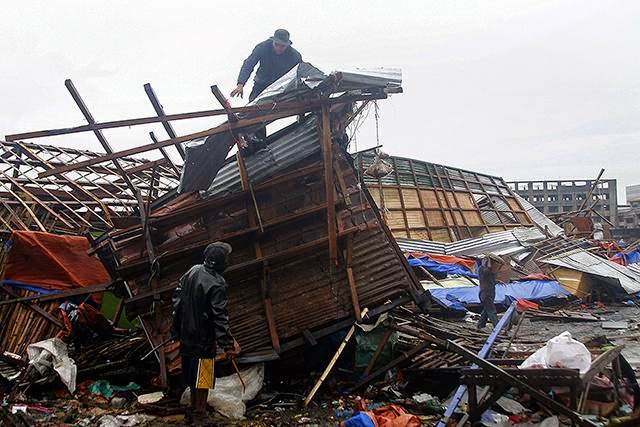
December 7, 2014. Tacloban, Philippines after Hagupit typhoon battered the city

Sandbag barrier set up on the Manila city beaches as Hagupit arrives

 Typhoon Ruby's winds begin pounding Capiz province early Sunday morning, affecting establishments including this hospital in Roxas City

Mud flows from Mayon Volcano flow down and covered roads in Barangay Maipon in Guiobatan town in Albay as Typhoon Ruby dumps rain in Bicol region

Borongon City flooded after Hagupit passed through it.

December 7, 2014. Legazpi as typhoon Hagupit strikes

Legazpi again

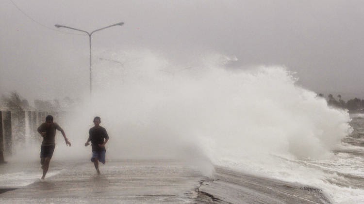
The sea turns wild at Borongon City, Philippines as Hagupit typhoon strikes

Storm surge: Sea water enters land

The path of typhoon Hagupit through Philippines, 2014

Flooding in Borongon city


Haiyan effect. 2013. The super typhoon had left thousands dead

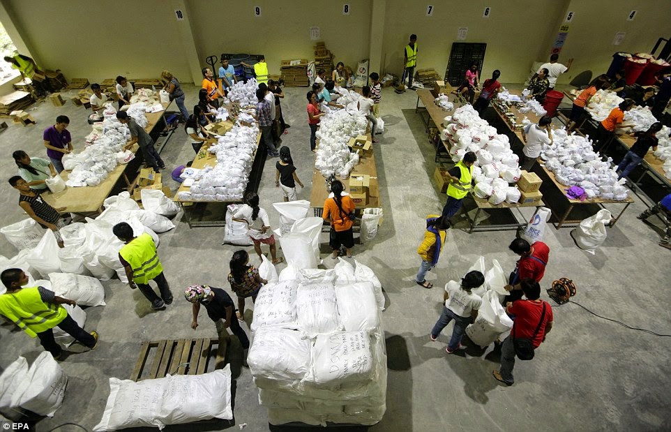
Relief supplies about to be sent. A relief center south of Manila.


Share this PostPin ThisShare on TumblrShare on Google PlusEmail This

Latest Forecasts/Updates


Popular Posts

Search This Site