Showing posts with label October. Show all posts

Future Monster Hurricane MATTHEW May Go Anywhere

SEPTEMBER 29, 2016, THURSDAY 

Tropical storm Matthew slowly moving west in the Carribeans has forecast models pointing at different directions when the future track of this soon to be monster hurricane is concerned.

Yesterday we had hinted it could hit Miami, Florida on October 6-7, 2016. This prediction we had based on the ever reliable European model, ECMWF. Today the ECMWF is predicting a different path. It expects a direct hit on Haiti on October 5, 2016. This model further says that this storm is going to be even stronger than earlier expected. After passing Haiti, it will intensify into a category 4 monster reaching a central minimum pressure of 927 hPa. That means winds in excess of 120 knots. Possibly Bermuda is in for a royal thrashing.

But as we said earlier different forecast models are saying different things. The National Hurricane Center says Cuba is for a rendezvous with Matthew. But it remains silent on where the hurricane will go after that. Head for Florida? Or swing away into North Altlantic Ocean?

The present situation is that it could go anywhere, from states adjoining the Gulf of Mexico (seems unlikely) to a hit on Florida (less unlikely) or sailing away into the Atlantic after giving Haiti or Cuba a good hiding.


UPDATE: SEPTEMBER 30, 2016, FRIDAY

Though the official National Hurricane Center forecast predicts hurricane Matthew will move through Cuba and into the Altlantic, the threat to Florida remains. The reliable ECMWF model foresees a hit on the state. Supporting it is the NHC-LBAR model. Even the GDFL and GDFN models predict a path close to Florida.

This storm has many folks in the weather forecasting community on tenterhooks. The red line is the ECMWF prediction. The white line with red dots is the official NHC forecast.


Share this PostPin ThisShare on TumblrShare on Google PlusEmail This

Cyclone HUDHUD UPDATE: Vital Misconceptions In Media: It is going to be Northern Andhra (Vizag) NOT Odisha


WE would like to point out some dangerous misconceptions that the media is spreading. Not only Indian media but the international media too. About Cyclone Hudhud.

FIRST: Many media sites are saying (including BBC) that cyclone Hudhud is going to strike the  Odisha coast at Gopal-at-Sea on October 12, 2014. This is wrong. The JTWC (Their forecasts are always accurate) says the storm is going to hit the Andhra coast near Visakhapatnam AND NOT Odisha. The distance between Gopal-at-Sea and Visakhapatnam is about 300 Kilometers. In disaster planning and preparedness this can make a hell of a difference.


SECOND: The BBC says winds, when the storm makes landfall, will be about 175 Kph. The JTWC in contrast (We agree with them) in its latest bulletin says the winds when Hudhud makes landfall on Saturday evening is going to be 220 Kph , GUSTING UP TO 260 kph. BBC bases its forecasts on Met Office (UK). Now the JTWC predictions are any day more trustworthy than that of the Met Office.

THIRD: Most media, including the BBC and IMD say that the cyclone is going to make landfall on Sunday (October 12, 2014) morning. The JTWC says the storm will hit the Andhra coast on Saturday evening. Just 50 hours left.

We think the confusion should be cleared at the earliest. The Andhra and Chattisgarh (It is going to see very heavy rains) governments should spring into action at the earliest (Just as the Odisha government is at maximum alert).

The danger is to Northern Andhra and Chattisgarh is as much as it is to Odisha (if not more).

People, please wake up. There are just 48 hours left.


Share this PostPin ThisShare on TumblrShare on Google PlusEmail This

Typhoon VONGFONG Will Slam Into Southern Japan October 12, 2014

Forecast Map: Typhoon Vongfong touches Japan on October 12, 2014

Though the JTWC does not confirm it presently, forecast models say that massive typhoon VONGFONG will slam into Japan on October 12, 2014. It will hit the country in almost the same area as Phanfone.

Vongfong is going to be massive storm with wind speeds reaching a staggering 280 kph on 9th and 10th of October. Luckily it will be some distance from Japan then.


LATEST UPDATE: OCTOBER 7, 2014 0800 HRS UTC: SATELLITE IMAGE OF TYPHOON VONGFONG


A Japanese video shot in Okinawa shows lightning prior to the arrival of Typhoon Vongfong
Share this PostPin ThisShare on TumblrShare on Google PlusEmail This

Monster Destructive Tropical Storm "PHANFONE" Will Hit Southern Japan On October 5, 2014

Satellite image of "Phanfone taken at 0600 GMT, October 3, 2014

This guy is a monster. No other word for it. Typhoon "Phanfone" is a monster, plain and simple.

Look at the diameter. As large as the length of Japan. It is going to throw out howling winds in excess of 270 KPH. Massive.

It will approach southern Japan on October 5, 2014. And move along the coast bringing lots of destruction. I am sure the Japanese authorities are well aware of the situation.

If you are going to be in Japan on October 5-6 October: My advise is board up well or head for the nearest storm shelter.

Phanfone is going to be a very nasty guy.

We had predicted Phanfone 10 days ago.

And another storm "Vongfong" is already brewing in the Pacific. It is expected that it will weaken and move away from Japan on around October 10, 2014.

Let us wait and see.
Share this PostPin ThisShare on TumblrShare on Google PlusEmail This

Tropical Storm "Phanfone" Has Formed: Will Intensify And Move Towards Japan

This satellite picture taken at 0600 Hrs, Sept. 27, 2014 shows 'Kammuri' nearing Japan and the area where 'Phanfone'was born

As 'Kammuri' moves towards Japan, another typhoon has formed in the Pacific. Phanfone.

The JTWC confirms the birth of the storm.

FORMATION OF A SIGNIFICANT TROPICAL CYCLONE IS POSSIBLE WITHIN 150 NM EITHER SIDE OF A LINE FROM 5.2N 166.5E TO 8.6N 160.6E WITHIN THE NEXT 12 TO 24 HOURS. THE POTENTIAL FOR THE DEVELOPMENT OF A SIGNIFICANT TROPICAL CYCLONE WITHIN THE NEXT 24 HOURS IS UPGRADED TO HIGH.


Phanfone will intensify and move towards Japan in the coming days. present forecasts say that it will near Japan till the 5th of October, 2014, than weaken and move away from the coast.

"Phanfone"means "animal" in Laotian. Let us see how much of a beast it turns out to be.


Update September 28, 2014, 0230 PM GMT: Typhoon Phanfone will hit Taiwan on October 5, 2014 according to latest forecasts.


XWF FORECAST PATH: Expected path of Typhoon Phanfone from now to Ocober 6, 2014
Share this PostPin ThisShare on TumblrShare on Google PlusEmail This

JAPAN'S WOEFUL FUTURE: After "Kammuri" Typhoon "Phanfone" Will Strike It Around October 7, 2014

Japan is going to face nature's fury in the coming fortnight.

Firstly big tropical storm "Kammuri" will hit central Japan near Tokyo on September 29, 2014. As if that was not bad enough, Kammuri is going to be followed by another storm, Phanfone.

Yes, we had earlier predicted that Phanfone would hit Taiwan, but latest forecasts say it is going to touch Japan in the very same area as Kammuri around October 7, 2014.

Thankfully, present indications are that Phanfone is not going to be as strong as Kammuri.

Japan's cup of woes seem to be spilling over as far nature is concerned.

XWF FORECAST MAP: Phanfone approaches Japan as seen on October 5, 2014. It will make landfall in another couple of days after this
Share this PostPin ThisShare on TumblrShare on Google PlusEmail This

AFTER KAMMURI, Typhoons Phanfone (Will Hit Taiwan October 8) and Vongfong To Form Quickly

The north western Pacific has started hurtling typhoons in quick succession! After Kalmaegi and Fung-wong we have predicted super-typhoon Kammuri will kiss central Japan on September 29, 2014.

But that is not the end of the story. Two more typhoons, Phanfone and Vongfong will quickly follow. Both will form east of the Philippines (That area of the Pacific is the womb of all storms hitting Asia).

Typhoon Phanfone will form as a low pressure area on October 2, 2014. It will then slowly intensify and move westwards. It will hit Taiwan on October 8, 2014.

Typhoon Vongfong will form in a near identical area as Phanfone on October 5, 2014, and follow an identical path as Phanfone. But it is difficult to say with surety now as to which way will Vongfong  go.

XWF WEATHER FORECAST MAP: This incredible map shows October 8, 2014; Typhoon Phanfone moves into Taiwan as Typhoon Vongfong is close behind.
Share this PostPin ThisShare on TumblrShare on Google PlusEmail This

Arabian Sea Storm May Hit Gujarat October 30, 2013. Is Cyclone HELEN Coming?

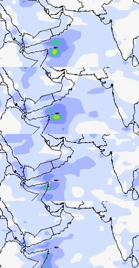
A storm will rise in the Arabian Sea. That much is for sure. Where it will go. Yesterday's forecasts said it would be Oman. Latest predictions say the depression will strike Gujarat (India) on October 30, 2013. Some forecasts say it might be a cyclone.


OCTOBER 29, 2013. HEAVY RAIN SYSTEM ABOUT TO MOVE INTO GUJARAT
AS WE SAID BEFORE IT IS EARLY DAYS. THE STORM SYSTEM MAY WELL TURN INTO A FULL BLOWN CYCLONE. IT MAY MOVE TO OMAN, PAKISTAN OR THE INDIAN COAST. THE NEXT FEW DAYS WILL GIVE US A BETTER PICTURE.

The present forecasts say that a low pressure area will form near the Kerala coast on October 24, 2013. It will strengthen and move north. Then it will gain power and move NW towards Oman. Once it is between the Indian and Omani coast it will turn into a cyclone and move towards Gujarat and hit it on October 30, 2013.

UPDATE: October 22, 2013

Latest forecasts say that the expected system will only be a weak low pressure area which will bring some rains to Mumbai at the end of the month.
Share this PostPin ThisShare on TumblrShare on Google PlusEmail This

A Rain Storm May Hit Oman On October 28, 2013

The SW monsoons have almost withdrawn from South Asia and one started thinking, well, the rain season is
 over. But the Arabian Sea may well spring a surprise if one goes by forecasts.

A low pressure area will develop near the Kerala coast on October 22, 2013 which will strengthen and move in a general NW direction across the Arabian Sea. It will (according to present forecasts) turn into a depression and hit Oman on October 28, 2013. What may follow is a deluge.


It is early days. Let us wait and watch.

OCTOBER 28, 2013. THE STORM IN THE ARABIAN SEA HITS OMAN

Share this PostPin ThisShare on TumblrShare on Google PlusEmail This

A New Storm To Develop In The Arabian Sea ON October 30, 2012

But the expected Bay of Bengal Cyclone NILAM is siphoning off all the moisture from the Indian Ocean south of Sri Lanka, so the expected storm in the Arabian Sea is going to be weak..

It will form 800 KMs west of Colombo potter around for a while than die down near the Kerala coast.

The expected co-ordinates of the new system....


 VERIFYING TIME     POSITION     STRENGTH        TENDENCY

  --------------     --------     --------        --------

 12UTC 29.10.2012   6.4N  70.9E     WEAK

 00UTC 30.10.2012   7.0N  71.1E     WEAK    INTENSIFYING SLIGHTLY

 12UTC 30.10.2012   6.8N  72.0E   MODERATE  INTENSIFYING SLIGHTLY

 00UTC 31.10.2012   7.6N  73.0E   MODERATE  INTENSIFYING SLIGHTLY

 12UTC 31.10.2012   8.6N  74.0E   MODERATE   INTENSIFYING SLIGHTLY

 00UTC 01.11.2012  10.0N  74.8E   MODERATE   INTENSIFYING SLIGHTLY

 12UTC 01.11.2012  11.1N  76.3E   MODERATE    WEAKENING SLIGHTLY

 00UTC 02.11.2012   BELOW TROPICAL STORM STRENGTH
Share this PostPin ThisShare on TumblrShare on Google PlusEmail This

Tropical Storm NILAM To Hit Tamil Nadu On October 31, 2012

 It is certain that the deep depression is hovering around in the Bay of Bengal. It is going to intensify further and move towards the Tamil Nadu coast in the next few hours.And hit it on October 31, 2012. The moot point is will it be strong enough to be christened NILAM by the stingy IMD?

Some forecasts say that the system is going to throw gale winds>>> 80-90 KMPH. Now that definitely means a cyclone. It should get the name NILAM. But IMD? Anyway.

Increasing wind speeds

Projected Path of Expected Cyclone NILAM  (October 29-October 31, 2012)

The deep depression over southwest Bay of Bengal near latitude 9.50 N and longitude 84.00 E, about 550 km southeast of Chennai (Tamil Nadu) and 300 km east-northeast of Trincomalee (Srilanka) is gong to intensify rapidly and hit the Tamil Nadu coast south of Chennai on October 31, 2012.

Very strong winds and lots of rains. So strong is the system that in the next few days it will move along northward and bring rains (Not only Tamil Nadu) to Andhra Pradesh, Maharashtra, Orissa, Jharkhand and Gangetic West Bengal.

Folks, bad girl NILAM is coming!
Increasing rainfall

Rain Prediction Map Oct. 30-Nov 3, 2012 Owing to Expected Cyclone NILAM
Share this PostPin ThisShare on TumblrShare on Google PlusEmail This

Cyclone NILAM May form In The Bay of Bengal: Cross Tamil Nadu Coast Oct. 31, 2012

The Bay of Bengal storm touches the Tamil Nadu coast south of Chennai. October 31, 2012
The Bay of Bengal seems to have grabbed NILAM from the Arabian Sea. Latest forecasts say NILAM will now form in the Bay of Bengal.and may cross the Tamil Nadu coast on October 31, 2012.

But the scenario is fuzzy right now. The expected storm may or may not be of Cyclone strength (May not be christened NILAM). It may turn out to be just a depression, deep or otherwise.

And as a result, lots of rains expected in Tamil Nadu and Andhra Pradesh on October 30-31, 2012

Rain prediction map. Lots of rain in Tamil Nadu on October 31, 2012
WHAT THE JTWC (JOINT TYPHOON WARNING CENTER) SAYS.....

THE AREA OF CONVECTION PREVIOUSLY LOCATED NEAR 10.6N 86.8E IS NOW LOCATED NEAR 9.7N 84.9E, APPROXIMATELY 345 NM EAST-NORTHEAST OF COLOMBO, SRI LANKA.

NUMERICAL MODEL AND INTENSITY GUIDANCE DEVELOPS THIS SYSTEM TO MINIMAL TROPICAL STORM STRENGTH OVER THE NEXT 24-36 HOURS AS THE STRONGER WINDS BEGIN TO WRAP AROUND THE LLCC.

THE POTENTIAL FOR THE DEVELOPMENT OF A SIGNIFICANT TROPICAL CYCLONE WITHIN THE NEXT 24 HOURS IS HIGH.

WHAT THE INDIAN MET DEPT SAY (TODAY OCTOBER 28, 2012, 5:30 AM)

The low pressure area over southeast Bay of Bengal and neighbourhood now lies as a well marked low pressure  area  over  central  parts  of  south Bay  of Bengal  and  neighbourhood. The  associated  upper  air cyclonic   circulation   extends   upto 3.1   Km   above   mean   sea   level.   The   system   may   concentrate  into a depression during next 24 hours.
Share this PostPin ThisShare on TumblrShare on Google PlusEmail This

Arabian Sea Claims MURJAN, Will Claim Cyclone NILAM Too!

Strange this year. Two cyclones in the North Indian Ocean in October, November 2012. Both in the Arabian Sea. And both expected to hit Somalia (Or at least affect)!

The first MURJAN is likely to enter Somalia today itself.

Cyclone MURJAN will enter Somalia today

The second cyclone, NILAM, will form on the 31st of October, 2012 off the coat of Somalia. It will intensify and touch the Horn of Africa on November 3 and then move northerly and make landfall on the Oman-Yemen border on November 5.

Folks in Oman! The remnants of NILAM will drift upwards towards entire Oman and the country may receive some showers around November 8, 2012. No heavy falls. But some rains possible.

Wind speed map. Predicted path of cyclone NILAM. Nov 1-Nov 5, 2012
As for the Bay of Bengal a system will try to form on October 28 off the coast of Visakhapatnam. But it will not gain much strength. Not even a low pressure. But there will be rains on the Tamil Nadu and North Andhra coast. These areas any way get rains now because it is the North East Monsoon season. But no significant storms likely in the future.
Share this PostPin ThisShare on TumblrShare on Google PlusEmail This

Expected Bay Of Bengal Cyclone MURJAN Will Hit Orissa On October 29, 2012


Cyclone Murjan will hit Orissa on October 28, 2012

We had predicted earlier that the expected tropical cyclone Murjan which is going to form in the Bay of Bengal (North Indian Ocean) will touch the Orisaa coast and then move into West Bengal.

Well, Murjan seems to have changed its mind. It is going to shower its "affections" only on Orissa. It is expected to hit the coast  at Gopalpur-in-sea on October 28, 2012 and drench the state in the next two days.


Point of impact. Murjan will hit the Orissa coat at Gopal-on-sea on October 28, 2012

Murjan is going to be a big nasty storm. High winds. Heavy rains. Super cyclone? May be.

It is time the Orissa government (I am sure they already are) start preparing for the worst. Murjan is going to be big bad boy.

Predicted path of cyclone "Murjan". October 26, 2012 to Oct. 28, 2012

Share this PostPin ThisShare on TumblrShare on Google PlusEmail This

Big Cyclone MURJAN Likely To Hit Indian East Coast On October 30, 2012

Weather Prediction map. October 30, 2012. Wind speed map. Red color is real bad news. Winds excess of 70 Kmph

It is October and time for the North Indian Ocean to churn up big destructive tropical cyclones. Well, this year is going to be no different. The Arabian Sea is going to spawn a low pressure area but it will move towards the Horn of Africa skipping its usual haunts, Gujarat and Oman.

But the main prediction is the big bad storm that the Bay of Bengal is going to engender. The birth place of the cyclone is going to be east of the Andaman and Nicobar Islands.On the 26th of October, 2012.


Rain prediction amp. October 27, 2012. Andaman, Nicobar Islands getting a drenching. Color pink means deluge.

After drenching the Andaman islands on the 27th the storm will rapidly gain strength and move north-westwards and reach the coast on the Orissa-Andhra Pradesh border on October 30, 2012.

Prediction now say it will then start losing steam and start moving along the coast in a north-easterly direction and make landfall on the Bangladesh-North East Indian border on October 31, 2012.

The places to get a real drenching? Andaman and Nicobar Islands, Northern Andhra Pradesh coastal areas, Orissa, Bangladesh coast and India's north-eastern states of Manipur, Mizoram, Tripura and parts of Assam. West Bengal, Bangladesh and the north eastern Indian states mentioned will receive rainfall till the 2nd of November.

Rain prediction map. October 31, 2012. The storm moves to make landfall. Light blue color means heavy rains
The scenario we have outlined is based on current forecasts. Cyclones are by nature very unpredictable so the expected storm may hit anywhere on the Bay of Bengal coast in Indian and Bangladesh.

Also we are now saying that the storm will weaken before it makes landfall. This too is hard to say with conviction.

One thing is certain. A big cyclone is going to form in the Bay of Bengal in the next ten days. The governments of India and Bangladesh will have to watch the seas closely in the next few days.

Rain prediction map. October 30, 2012. The storm drenching coastal Andhra Pradesh and Orissa.
UPDATE: OCTOBER 21, 2012, O6.54 UTC

Latest forecasts say that the storm is going to hit the Orissa coast on the 29th of October, 2012. It will them move into West Bengal and traverse the state moving northwards.Heavy rains throughout West Bengal (October 30, 2012), North Bengal, Sikkim and eastern Nepal on the 31st October, 2012. Orissa coast is in for strong gale and heavy downpour on the 29th of October.


Rain prediction map. Oct. 29 to Oct. 31, 2012. Cyclone Murjan


Share this PostPin ThisShare on TumblrShare on Google PlusEmail This

Latest Forecasts/Updates


Popular Posts

Search This Site