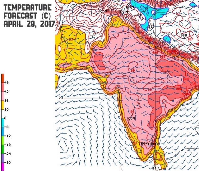
Maharashtra, Telangana Wettest This Monsoon?

APRIL 30, 2017

This year the monsoon gods are going to smile broadly at Maharashtra and Telangana if latest data from the CFS (Coupled Forecast System) model is to be believed.

Looking at rainfall anamoly maps for the four monsoon months we see these two states will receive above average precipitation in each of them. 2-4 inches in excess of the monthly average.

The green colour in the maps denotes excess, above average rainfall. The brown color means deficient rainfall.

Advertisement


In June the Arabian Sea is going to hit the turbo mode, churning out many rain systems. At least one of them is going to hit Oman. Good rains in coastal Pakistan, south Gujarat, Maharashtra, western Madhya Pradesh, northern Karnataka, Telangana, Kerala, Bihar and Jharkhand.

In July good rains in coastal Saurashtra, south Gujarat, Maharashtra, northern Karnataka, Telangana, southern Chattisgarh, eastern Uttar Pradesh and parts of Odisha and Bengal. The North Eastern states will face a dry spell in July. As will Karnataka, Kerala and Rayalseema.

In August the good times continue in Maharashtra, Madhya Pradesh, Telangana, Chattisgarh. Bengal and Bihar will receive good rains. Below average rains I am afraid in Tamil Nadu, Karnataka, Kerala and Rayalseema.

September will see both the Arabian Sea and Bay of Bengal turning active throwing out low pressure systems. As a result we will see good precipitation in almost entire India except for Rajasthan and northern India. Seeing the likelihood of good rains in September we may say the positive Indian Ocean Dipole will nullify any impact of a weak El Niño.

Share this PostPin ThisShare on TumblrShare on Google PlusEmail This

Monsoon May Hit Kerala A Week Earlier

APRIL 23, 2017, SUNDAY

Climate forecast models are hinting that the south west monsoon may arrive in India almost a week earlier. It is likely we may see the onset in the Indian state of Kerala around May 24, 2017.


We have written about an early monsoon almost a month ago. Our conclusion is being supported by latest forecast data from the American CFS (Coupled Forecast Model).

Forecast charts for latter half of May show a sudden increase in thunderstorm activity near Cape Comorin, the coast off Kanyakumari. There will be heavy rainfall activity in Kerala and adjoining Arabian Sea.

It is possible that from that intense rainfall activity might emerge a low pressure system or even a tropical cyclone that will push early rains into Gujarat, Rajasthan and Delhi. Or a low pressure system may move to Oman by June 1.

Earlier we had predicted that the Arabian Sea will turn active from June 1, 2017. It seems nature has preponed things by a week.

Watch the Arabian Sea in the last week of May. The rain gods are going to wake up in South Asia in a month's time from now.


Share this PostPin ThisShare on TumblrShare on Google PlusEmail This

Positive Indian Ocean Dipole To Intensify Monsoon 2017


APRIL 22, 2017, SATURDAY

There is good news for India this year. The European forecast model ECMWF has predicted that the patron saint of South Asian monsoon, the Indian Ocean Dipole (IOD) is going to start turning positive from June 2017. And it is going to become even more stronger by September. We all know that a positive IOD means good monsoon rains in India, especially the Arabian Sea wing of the monsoon.


What is the Indian Ocean Dipole? This is a coupled phenomenon where the eastern and western parts of the Indian Ocean get alternately hotter or colder than the other part. When the western part gets warmer than the eastern part, it is called positive IOD. The coast near Africa Somalia gets warmer, throws out more thunderstorms and rain clouds into the Arabian Sea ultimately.


The Arabian Sea was impotent in 2016 because it was a negative or neutral IOD year. That is why there were no tropical cyclones in the sea last year. The Arabian Sea wing of the monsoon in 2016 was almost non-existent.

Not this year.

This year as IOD turns positive by June 2017, the Arabian Sea is going to turn into a vigorous stud, hurling thunderstorms, depressions, cyclones and what not.

The CFS model has confirmed that the sea is going to turn over-active in June. Watch out , Gujarat, Sindh, Oman. The Arabian Sea is going to marry IOD in June and going bear many storms.

Lastly we have to mention that there is going to be a worm in the monsoon 2017 soup. El Niño is going to turn positive by August. The fate of the monsoon this year will be decided by the tug-of-war between IOD and El Niño. Who will win? If IOD wins, we will have a good monsoon. If El Niño wins we will have a poor August-September monsoon.


Share this PostPin ThisShare on TumblrShare on Google PlusEmail This

Heat Wave To Ease In North, NW India, Remain In East India

APRIL 17, 2017

The current heatwave in India has made life miserable in most parts of the country with maximum temperatures soaring to 46 degrees C in many places.

Advertisement

Forecast models say it will continue in central Gujarat, Rajasthan, Delhi, Punjab, Uttar Pradesh, Madhya Pradesh, Odisha, Chattisgarh and Telangana for the next few days. (SEE TEMPERATURE FORECAST MAP BELOW)

The areas in red show regions with high temperatures between 42-46 degrees centigrade.

But things will improve in northern and northwestern India after 4-5 days. (SEE FORECAST MAP BELOW). But high temperatures above 42 degrees Centigrade will continue in eastern Uttar Pradesh, Bihar, Odisha, parts of Telangana, Andhra Pradesh. She me parts of Sindh see the temperature soaring in the next 10 days.

The areas in red show regions with high temperatures between 42-46 degrees centigrade.


Share this PostPin ThisShare on TumblrShare on Google PlusEmail This

Some Signs That Monsoon 2017 Is Preparing To Come

APRIL 17, 2017, MONDAY

The south west monsoon is still about 40 days away, before it arrives to an eagerly awaited welcome to the Indian subcontinent but we can discern some signs that hint at its arrival.


The first is the strong almost daily thunderstorm activity in the Indian North Eastern states, like Assam, and also in Myanmar and Bangladesh. The daily precipitation in these areas started almost a fortnight ago. A look at accumulated rainfall forecast by the reliable ECMWF model reveals that in the coming days the pre-monsoon activity is going to become very vigorous.(SEE FORECAST MAP). Moreover the thunderstorm activity is becoming vigorousl in south eastern Bay of Bengal from where the monsoon enters each year.


Secondly, the wind direction in the Bay of Bengal and Arabian Sea has reversed in the last few weeks as the winter northeast monsoons have long departed. The winds are beginning to blow in Gujarat and parts of Sindh from the Arabian Sea. As strong pre-monsoon winds push up from Somalia.

Similarly in the Bay of Bengal moist winds are moving up north hitting Myanmar, Bangladesh and India's North East bringing pre-monsoon thunderstorms in these areas. The recent tropical cyclone MAARUTHA is going to act as a catalyst speeding up the arrival of the monsoon.


The CFS model has predicted that pre-monsoon activity is going to start in Gujarat, Sindh, Maharashtra and parts of Rajasthan in mid May itself.And that monsoon is going to become vigorous in both the Arabian Sea and Bay of Bengal from June 1, 2017 itself. Both the seas are going to throw out at least a tropical cyclone/depression/low pressure system each in June. Good rains are expected in Odisha, Gujarat, Sindh and Oman in June.
Share this PostPin ThisShare on TumblrShare on Google PlusEmail This

Cyclone MAARUTHA Hurtling Towards Myanmar

UPDATE, APRIL 17, 2017

The cyclone made landfall near Sandoway around midnight and moved inland. Latest satellite image shows the system has weakened to a low and is over interior Myanmar now.


UPDATE APRIL 16, 2017, 1530 IST 

Presently tropical cyclone MAARUTHA lies about 150 kilometres from the Myanmar coast. It is raining very heavily in Rakhine state around Sandoway. Our estimate is it will make landfall at 2300 hours, Myanmar local time.

The pink color denotes areas of very heavy rainfall.

APRIL 16, 2017, SUNDAY 

The deep depression in the Bay of Bengal intensified further into tropical cyclone MAARUTHA last night. Current wind speeds of the storm are 65-70 km/h. It lies presently about 300 kilometres from the coast of Myanmar.

By early Monday morning it will make landfall into the country's coast between Sittwe and Sangoway near Ramree and Cheduba islands. Wind speed at impact will be 75 km/h. There will be flooding rainfall in that part of Rakhine state. Though precipitation has already started in many parts of coastal Myanmar.

Capital Naypyidaw will receive heavy thundershowers by noon tomorrow as the weakening system moves inland.

The Joint Typhoon Warning Center predicts MAARUTHA will hit the Myanmar coast at midnight with winds of 65-70 km/h. Our estimate is they will be higher.


Share this PostPin ThisShare on TumblrShare on Google PlusEmail This

India Weather Forecast:Showers in Assam

APRIL 15, 2017

While the Bay of Bengal deep depression will bring a deluge to Myanmar, barring Assam India will remain largely dry.

Thunderstorms are likely in parts of Assam accompanied by lightning today late night even as the Bay of Bengal depression starts drenching coastal Myanmar.

The Myanmar coast near Sangoway and perhaps Pathein will receive heavy rainfall as the Bay of Bengal depression hits the country early Monday morning.

Share this PostPin ThisShare on TumblrShare on Google PlusEmail This

Bay Of Bengal System Strengthening To Deep Depression Soon

APRIL 15, 2017

The low pressure area in the Bay of Bengal moved further north and intensified into a depression today. It lies a few hundred kilometres west of Andaman Islands. It will continue to strengthen and move in a north northeasterly direction.

It is expected to make landfall into Rakhine state of Myanmar near Sittwe on early Monday morning. Our estimate is that the system will grow into a 64 km/h deep depression at most. A borderline case between a deep depression and weak tropical cyclone.

Though the American GFS model continues to insist on a 100-120 km/h tropical cyclone. If it does become one it should be named MAARUTHA. Though doubts remain about the name of the next North Indian Ocean tropical cyclone, with some weather sites saying it will be MORA. Others say it will be ASIRI.

The US Navy's JTWC (Joint Typhoon Warning Center) believes the chances of a tropical cyclone are high.
GLOBAL MODELS ARE IN GOOD AGREEMENT THAT THE 
DISTURBANCE WILL CONTINUE TO TRACK TO THE NORTHEAST OVER THE NEXT 
SEVERAL DAYS, WITH TROPICAL CYCLOGENESIS LIKELY OCCURRING WITHIN THE 
NEXT 24 HOURS. MAXIMUM SUSTAINED SURFACE WINDS ARE ESTIMATED AT 25 
TO 30 KNOTS. MINIMUM SEA LEVEL PRESSURE IS ESTIMATED TO BE NEAR 1000 
MB. THE POTENTIAL FOR THE DEVELOPMENT OF A SIGNIFICANT TROPICAL 
CYCLONE WITHIN THE NEXT 24 HOURS IS HIGH.


Share this PostPin ThisShare on TumblrShare on Google PlusEmail This

Tropical Storm, MAARUTHA, To Form April 15

APRIL 14, 2017

The low pressure area that has formed in the Bay of Bengal lay a few hundred kilometres east of the coast of Tamil Nadu today early morning. It was throwing out winds of 35-40 km/h then.

It is intensifying all the time and moving quickly in a northerly direction away from the Indian mainland. The American GFS model expects it to turn into a tropical storm by Saturday morning when it will be close to the Andaman Islands. This model expects it to reach wind speeds of 120 km/h when it hits the Myanmar coast at Rakhine, south of Sittwe on Monday morning.

Other models too expect a Rakhine landfall on April 17 but they expect the system may remain just a deep depression, not a tropical cyclone, reaching sustained winds of 60 km/h.

But it is going to bring very heavy rainfall to Andaman Islands and in Myanmar by April 20, 2017.

Latest data from the GFS model says MAARUTHA is going to intensify into a 150-170 km/h monster with a central minimum pressure of 957 hPa before landfall into Myanmar in the early hours of Monday. Very worrying news for the authorities and people of the country.

Bay of Bengal depression April 2017

Share this PostPin ThisShare on TumblrShare on Google PlusEmail This

XWF WEATHER Long Range Forecast: Arabian Sea Tropical Cyclone In June 2017

APRIL 14, 2017

The US Climate Prediction Center has hinted strongly at the possibility of a tropical cyclone in the Arabian Sea in early June this year. 

The CPC's CFS (Coupled Forecast System) model has been consistently showing a tropical depression/cyclone forming in the Arabian Sea in June. Recent data indicate a tropical cyclone taking shape off the Kerala coast around June 6-7, which intensifies and goes on to make landfall into Oman on June 14, 2017.

Please keep in mind that the CFS is a climate forecast model, unlike the GFS and ECMWF. So the accuracy about the track and date of the expected storm is bound to be comparatively less. But this model, as we have observed now and again, has been good at giving out possibilies of tropical storm formation.

We can say this with some certainty that a tropical storm is imminent in the Arabian Sea this June. When it forms is to be seen. Where it goes, Gujarat, Sindh or Oman, is uncertain at this stage.

There is an equally good possibility that a tropical cyclone may form the in the Bay of Bengal around June 25, 2017. The onset of monsoon over India is going to be early and strong according to the American climate forecast agency.

Renowned Indian meteorologist PV Joseph, a former director of Indian Meteorological Department, too says the monsoon will hit India earlier in 2017 around May 24.

Studying the data from the CFS model in the last few days, one sees the South West monsoon becoming very active  since the start of June, 2017, in the Arabian Sea. A couple of rain bearing systems will push monsoons onto the Indian west coast, including Gujarat and Sindh by June 10. So the start of the monsoon this year is going to be timely and vigorous.

Arabian Sea tropical cyclone June 2017 CFS forecast

Share this PostPin ThisShare on TumblrShare on Google PlusEmail This

European Model, ECMWF Paints Gloomy India Monsoon 2017 Picture

APRIL 13, 2017, THURSDAY

The rainfall prediction for India this year's monsoon is poor. That is if the prediction by the European weather forecast agency's ECMWF model is to be believed. 

On the whole rainfall will be normal till September end in most parts of India, barring Kutch, parts of Saurashtra, North Gujarat, entire Rajasthan, Haryana, Punjab, Jammu Kashmir, Bengal and the North Eastern states. Rainfall will be deficient in these areas. On the whole it will bring down the monsoons to 90-95% of average. That is if there are no depression/cyclones in October/November which bring prodigious amounts of water and push up the percentage and reduce the gloomy scenario.

The ECMWF says that there will be good rains on the Indian west coast barring Gujarat in July and August. But the rains will dry up in August, September in the whole country. I guess this will be because of the bad man El Niño kicking in then.


There is bad news for Pakistan and Bangladesh too. It will be below normal monsoon in these two countries.

This prediction is based on analysis of climate data available till March 1, 2017 by the premier forecast agency. It would be interesting to see if there are changes in subsequent long range forecasts.


Share this PostPin ThisShare on TumblrShare on Google PlusEmail This

Bay of Bengal Storm (MAARUTHA) To Hit Myanmar April 17-18, 2017

APRIL 13, 2017, THURSDAY 

The expected deep depression/tropical cyclone MAARUTHA in the Bay of Bengal will be spawned as a low pressure area today a few hundred kilometres east of the Sri Lankan coast. Forecast models say it will go on ultimately and hit the coast of Myanmar at Sandoway on April 17-18, 2017.

This system will intensify rapidly after forming today evening, Indian Standard Time, IST. It will move rapidly in a north northeasterly direction, strengthening all the time. It will move past Andaman Islands in the next 48-72 hours. By Saturday it will turn into full blown tropical storm.

It remains to be seen if the IMD (Indian Meteorological Department) deems it fit to be a tropical cyclone MAARUTHA or labels it just a deep depression. Our estimate is that the system will be throwing out sustained winds of 65-75 km/h by April 16. A tropical cyclone.

The storm will weaken into a depression before landfall into the Rakhine state of Myanmar near Sandoway on April 18, 2017. It will bring heavy rains to Andaman and Nicobar islands and Myanmar in the coming days. Our estimate is at least 8-10 inches of torrential precipitation.

American GFS model predicts a stronger storm. It envisages the system moving more quickly and hitting Myanmar south of Sittwe on April 16. Thus leaving even less time for authorities in Myanmar to prepare for this imminent quick moving threat. The country's disaster relief personnel should swing into action at the earliest to take preemptive measures to mitigate the losses.

Our advice to tourists in the Andaman and Nicobar islands is to go to nearby storm shelters or leave for the mainland earliest possible. The weather is going to be very nasty in the coming days.

Probable position of Bay of Bengal storm on April 16, 2017.
Disturbed conditions in Bay of Bengal presently. The yellow and red dots denote lightning. The dark blue color shows heavy precipitation.
Total accumulated rainfall till April 22, 2017
Share this PostPin ThisShare on TumblrShare on Google PlusEmail This

Bay of Bengal Depression/Tropical Cyclone Is Being Born

APRIL 12, 2017

A low pressure area is being gradually formed in the Bay of Bengal. A look at the latest satellite image of the sea reveals massive clusters of disturbed weather and powerful thunderstorms. From this morass of clouds will emerge a rain system between Nicobar islands and the Indian mainland.

Global forecast models are divided over whether this low will intensify into a deep depression or tropical cyclone MAARUTHA. The American GFS is clear in portending a cyclone. It predicts a tropical storm nudging along the Myanmar coast bringing a deluge to these areas.

Other models expect a deep depression or a weak tropical storm to form in the next 48-72 hours. The system will move north northeasterly and head for the border of northern coastal Myanmar and Chittagong region of Bangladesh. 

Whatever happens, Indian Andaman and Nicobar islands are in for a deluge in the coming days. Upto a metre of rainfall may occur. Tourists visiting these islands are advised to head to safer areas or leave for mainland India as soon as possible as the weather in the Bay of Bengal is going to be very disturbed in the next coming 5-7 days.

Disappointingly for drought hit Tamil Nadu the present expected storm system will not give it the much needed rain, though Sri Lanka will experience heavy showers under its influence.

Rains will come to Tamil Nadu by the end of this month, but it will be owing to another system.

The pink denotes areas of very heavy rainfall presently.


Share this PostPin ThisShare on TumblrShare on Google PlusEmail This

Cyclone MAARUTHA Imminent In Bay of Bengal?

APRIL 11, 2017

Something like this was bound to happen, given the searing abnormal temperatures in many parts of India. It is possible that we may see the Bay of Bengal spawn a powerful tropical cyclone by April 14-15, 2017. It will be named MAARUTHA.

Major global weather forecast models are suggesting that a low pressure area will form in the Bay of Bengal west of the Andaman Islands in the next 3-4 days.


The American GFS model says outright that this system will intensify into a powerful cyclone by April 17-18. At present it says the storm will go on and hit the northern coast of Myanmar just south of Chittagong around April 20.

Other models are more sanguine. They do predict a big depression/tropical storm but are not sure about its track. They say it will weaken into a low pressure system by April 18-19.

There is a strong possibility that the system will intensify at most into a deep depression, just short of a tropical storm.

We have to wait and see if MAARUTHA does form. And if yes, where it goes finally.

Windy torrential rainfall of 10-20 inches is expected in Andaman Islands in the coming days due to the influence of this system. And if it hits northern Myanmar expect floods in that part of the country.


Share this PostPin ThisShare on TumblrShare on Google PlusEmail This

Western Disturbance To Bring Rain/Snow To North India

APRIL 4, 2017

Another western disturbance is approaching northern India. It will bring rains to Delhi today evening. Heavy snowfall will result in parts of Kashmir and Himachal Pradesh till Friday.

Temperatures will plummet as a result in Rajasthan, Gujarat, Delhi, and northern India by as much as 4-6 degrees centigrade in the coming days.

Showers will begin Tuesday evening in capital Delhi. There might be more showers on Wednesday.

Uttarakhand, parts of Haryana, Punjab, Jammu and parts of Himachal Pradesh will see intermittent showers in the coming 72 hours. Shimla and parts of Himachal Pradesh may see snowfall.

Heavy rains are also likely in northern Pakistan around Lahore in the next 48 hours.


Share this PostPin ThisShare on TumblrShare on Google PlusEmail This

Sea Off North Western Australia To Spawn Many Storms In April 2017

APRIL 2, 2017

After the dangerous typhoon Debbie, the seas off the Australian coast is going to see hectic storm activity. And all of it will occur in the Timor Sea and adjoining Indian Ocean off the coast of Northern Territory and Western Australia.

Almost all forecast models are predicting 2 or 3 depressions or tropical storms in that area of the ocean. This will happen in the coming days around April 10. Two of the storms may sail harmlessly west into the Indian Ocean without landfall into the country-continent.

But the third one that will form off East Timor is the one to watch out for. The American GFS model expects it to intensify into a 955 hPa monster and hit the coast of Western Australia between Broome and Port Hedland on April 11-12, 2017.

The expected storms will be named Cempaka or Ernie depending on where the cyclone forms, in the waters of Indonesian Met jurisdiction or in BOM (Australian Bureau of Meteorology) waters.

Latest forecasts hint at the possibility of the formation of two tropical storms. The first will start off as a low pressure area on April 5 south of Java. The second low pressure system will form around April 9 in Timor sea north of Darwin.

The American CPC (Climate Prediction Center) in it's latest report says, "GEFS indicates that the Timor Sea region to the north of Australia has an elevated risk of tropical cyclone development".


Share this PostPin ThisShare on TumblrShare on Google PlusEmail This

Rain, Thunderstorms Expected In Indian North East In Coming 10 Days

APRIL 2, 2017

Pre-monsoon rainfall is in full swing in the North Eastern states of India. And they will continue in the coming 10 days according to reliable ECMWF and other European weather forecast models.

Though maximum thunderstorms will occur in Assam, Arunachal Pradesh, Tripura, Manipur, Mizoram, Nagaland and Bangladesh, rains will also occur in Kashmir and Himachal Pradesh and parts of Uttarakhand in the coming 10 days. Isolated thundershowers are expected in Gangetic Bengal and coastal Odisha.

Significantly, thundershower activity will start in the Indian bellwether  state of Kerala in the coming days. The warning siren that monsoons are going to come.


Share this PostPin ThisShare on TumblrShare on Google PlusEmail This

Latest Forecasts/Updates


Popular Posts

Search This Site