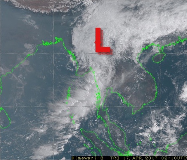
UPDATE, APRIL 17, 2017
The cyclone made landfall near Sandoway around midnight and moved inland. Latest satellite image shows the system has weakened to a low and is over interior Myanmar now.
UPDATE APRIL 16, 2017, 1530 IST
Presently tropical cyclone MAARUTHA lies about 150 kilometres from the Myanmar coast. It is raining very heavily in Rakhine state around Sandoway. Our estimate is it will make landfall at 2300 hours, Myanmar local time.
The deep depression in the Bay of Bengal intensified further into tropical cyclone MAARUTHA last night. Current wind speeds of the storm are 65-70 km/h. It lies presently about 300 kilometres from the coast of Myanmar.
By early Monday morning it will make landfall into the country's coast between Sittwe and Sangoway near Ramree and Cheduba islands. Wind speed at impact will be 75 km/h. There will be flooding rainfall in that part of Rakhine state. Though precipitation has already started in many parts of coastal Myanmar.
Capital Naypyidaw will receive heavy thundershowers by noon tomorrow as the weakening system moves inland.
The Joint Typhoon Warning Center predicts MAARUTHA will hit the Myanmar coast at midnight with winds of 65-70 km/h. Our estimate is they will be higher.


No comments:
Post a Comment