Two Low Pressure Areas: Rains In Oman And West Bengal Expected

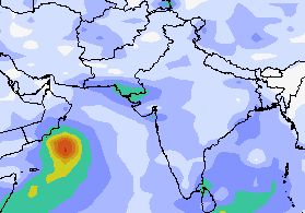
XWF WEATHER PREDICTION MAP: SATELLITE IMAGE TAKEN TODAY SHOWS THE TWO LOW PRESSURE AREAS, ONE EACH IN THE BAY OF BENGAL AND ARABIAN SEA (WILL FORM ON MAY 30)

Today we shall talk about two low pressure areas (LPA). One in the Arabian Sea, the other in the Bay of
Bengal. One has already formed. The other will take shape on May 30, 2013.

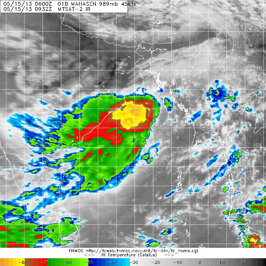
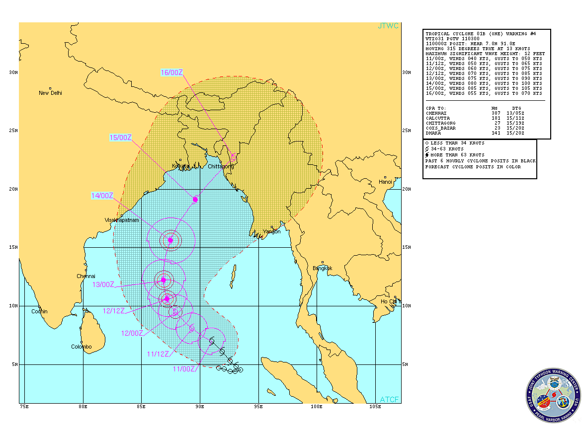
As we had forecasted earlier,  a low pressure has formed in the Bay of Bengal. We had also said that this system would make landfall two days later and bring heavy rains in Bangladesh and West Bengal. Well, there has been a slight change of plan. The LPA will not go straight into Bangladesh. But it will hover around for some time near the Orissa coast then move into land on May 29, 2013 at the Orissa-West Bengal border. It will then curve into West Bengal bringing heavy rains in the state for the next 3-4 days. North Bengal will get rains on June 1, 2013. Heavy rains, if I may so.
.
Then the system will drench north Bangladesh on June 2, 2013. I am talking of Rangpur, Dinajpur, Panchgarh and Thakurgaon.

The Arabian Sea LPA will form on May 30, 2013. It will move along the Oman coast in a northerly direction, giving rains to the coastal areas. Muscat may get some rains on June 4-5, 2013. It may rain in Abu Dabhi, Dubai and Doha around May 6, 2013. Muscat will get some good showers on June 5-6, 2013.
Share this PostPin ThisShare on TumblrShare on Google PlusEmail This

Low Pressure Area To Bring Heavy Rains In Bangladesh And West Bengal Next Week

SATELLITE IMAGE TAKEN TODAY (MAY 25, 2013) SHOWS THE AREA OF DENSE CLOUDS NEAR THE MYANMAR COAST IN THE BAY OF BENGAL. THESE WILL GIVE BIRTH TO THE LOW PRESSURE AREA ON MAY 27.

Bangladesh and West Bengal are in for a thorough drenching

next week. This will be as a result of a low pressure area that is likely to form in the Bay of Bengal on May 27, 2013.


Now this rain system will form a few hundred kilometers south of the Bangladesh coast.Then it will start moving northwards gradually in the next two days and make landfall on May 29, 2013.

Very heavy rains are forecast in SW Bangladesh on May 29. It will also rain heavily in Gangetic West Bengal on May 30.

After that the system will move into Assam on June 1, 2013.

The verdict? Very heavy rains in Bangladesh from May 29 to May 31.
Share this PostPin ThisShare on TumblrShare on Google PlusEmail This

Mumbai Is In For A Deluge From June 6, 2013

XWF RAIN PREDICTION MAP: JUNE 9, 2013: DELUGE APPROACHES MUMBAI

The monsoon is going to come early this year. And it is going to be vigorous.

Things are happening in the Bay of Bengal right now as monsoon winds enter it from the east. Within days Bay of Bengal is going to be laden with rain-bearing monsoon clouds.

Pre-monsoon showers are going to begin in the Indian west coast too within a few days. Dry Gujarat too will get light rains within a week.

But the forecast that interests us greatly is Mumbai. The metropolis is in for a huge deluge around June 9, 2013. This will be partly as a result of a Bay of Bengal low pressure area which will reach it on June 9. And partly because of a rain bearing system which is hovering around in the Arabian Sea since the last few days

This system will move towards the Oman coast in the next few days, bring southern Oman some rains on May 30, 2013. The system will then potter around near the Omani coast for some time and then start moving in an easterly direction towards the Indian coast.

June 9, 2013. The two systems will collide. And BOOM! Very heavy rains on the entire Indian west coast stretching from Gujarat to Goa. Mumbai will get very heavy rainfall for a few days.

Folks in Mumbai. Be prepared for a drenching on June 9, 2013.

Latest forecasts say the drenching in Mumbai will start from June 6, 2013 and continue for 5-6 days.

Keep reading this site for latest updates.
Share this PostPin ThisShare on TumblrShare on Google PlusEmail This

XWF-LRF: A CYCLONE (PHAILIN) MAY HIT OMAN ON JUNE 9. 2013.

XWF-LRF RAIN PREDICTION MAP: CYCLONE PHAILIN ABOUT TO HIT OMAN COAST: JUNE 9, 2013
According of our Long Range Forecasts, a cyclone (Phailin?) will strike Oman on June 9, 2013. The storm
will take shape off the Karnataka coast in India on June 6, 2013. It will then move in a NW direction, intensifying all the time and then cross the northern Oman coast  on June 9, 2013.

It will be according to XWF-LRF, a very powerful cyclone. Very strong winds and heavy rains are expected  in northern Oman on June 9, 2013.

Please note that this is a LRF and its accuracy is circumspect.
Share this PostPin ThisShare on TumblrShare on Google PlusEmail This

VERY HEAVY RAINS LIKELY IN SOUTHERN OMAN ON JUNE 6, 2013

XWF RAIN PREDICTION MAP: JUNE 6, 2013: HEAVY RAINS IN SOUTHERN OMAN


We had predicted earlier that there would be some rains in southern Oman on May 30, 2013.
Well there is going to be some rain on May 30, 2013. But there have been new developments.

A rain bearing cloud system has been hovering around in south Arabian Sea for some days now. This system is going to slowly move towards the coast of southern Oman during the next seven days. Once it comes near the coast it will turn into a low pressure system (may be even a depression) and linger over the Arabian Sea near the coast for the next few days giving intermittent rains in southern Oman.

It is on June 6, 2013, that this system will move into Oman and then there will be a deluge for the next two days in southern Oman. Very heavy rains are likely in Sawqirah, Sharbatat, Duqm, Hayma, Marmul, Dawkah, Thamarit and Sadh on June 6-7.

Moderate winds may lash the south Oman coast in the first week of June. The sea is going to be rough.
Share this PostPin ThisShare on TumblrShare on Google PlusEmail This

XWF-LRF: HEAVY RAINS IN OMAN ON JUNE 12, 2013

XWF-LRF: Heavy rainfall in Oman on June 12, 2013
We are making our first LRF (Long Range Forecast). Heavy rains are likely in Oman on June 12, 2013.This
will be the result of a low pressure area formed in the Bay of Bengal on June 6, 2013. By then the monsoons will have set in the Bay of Bengal. This low pressure area will travel through India (Orissa, northern Andhra Pradesh, Maharashtra) and then enter the Arabian Sea on June 9, 2013.

It will then move westwards and hit Oman on June 12, 2013.

Now please note that this is an long range forecast and prone to inaccuracy.

Let us wait and see how things pan out.

XWF-LRF RAIN PREDICTION MAP: COURSE (JUNE 7, 2013 TO JUNE 12, 2013) OF THE LOW PRESSURE AREA WHICH WILL BRING RAINS TO OMAN ON JUNE 12, 2013.

Share this PostPin ThisShare on TumblrShare on Google PlusEmail This

A Rain System Will Touch Southern Oman On May 30, 2013

Presently things are very boring in the North Indian Ocean after the departure of MAHASEN. It is only in the end of the month that the SE monsoons will start approaching South Asia. But there is another interesting development in the Arabian Sea. No it is not a cyclone, nor even a depression.


But I am talking of the mass of rain-bearing clouds in south Arabian Sea. They have been there for quite a few days now. Initially it was expected that they will give birth to a substantial storm.

But forecasts now say the system will start moving gradually towards the coast of southern Oman and give some rains on May 30, 2013. It will rain heavily in the next two days in the sea off the coast. Then this system will move in a  NE direction and bring heavy rains to the Saurashtra (India) coast on May 6, 2013.

There are still some days to go. Will the rain system behave as we have predicted? Or will it change its mind and turn into something more substantial?

Let us wait and watch.

Xtreme Weather Rain Prediction Map; May 30, 2013. Rainfall in southern Oman

Xtreme Weather Rain Prediction Map: June 2, 2013. Heavy rains off the coast of southern Oman

Xtreme Weather Rain Prediction Map: June 5, 2013. The system now reaches the Gujarat coast and brings heavy rains

Share this PostPin ThisShare on TumblrShare on Google PlusEmail This

SOUTH ASIAN MONSOON MAY ARRIVE EARLY THIS YEAR (2013)

A low pressure area will form on June 1, 2013 in the Bay of bengal. The map shows the predicted position around June 4, 2013. See also the heavy rains approaching Mumbai
Looks like the Arabian Sea is not going to throw up a tropical storm in May this year. May be MAHASEN has sucked off  all the moisture and  storm potential in the North Indian Ocean, leaving the Arabian Sea dry. A rain system may develop near the Horn of Africa around May 30, 2013, which will bring some rains to east Yemen and southern tip of Oman.

A notable development is the formation of a low pressure in the Bay of Bengal on June 1, 2013. The monsoons may come 5 days earlier this year as a result.

Now this low pressure area is likely to move northward and bring rains to Andhra, Orissa, Chattisgarh, Bihar and West Bengal after June 5th. Or the system may move in a NW direction; then the western states of India (Gujarat and Rajasthan) are in for a deluge.

Interestingly forecasts say heavy rain may occur in Mumbai on June 5th, 2013.
Share this PostPin ThisShare on TumblrShare on Google PlusEmail This

ARABIAN SEA MAY 2013: SITUATION FLUID: A LOW PRESSURE AREA HAS FORMED

A great mass of dense clouds hover over southern Arabian Sea. This mass has a great potential of throwing out many possibilities. A low pressure area? A cyclone? A super cyclone? Where? Gujarat? Oman? Pakistan?

Conditions are very fluid and model forecasts are a little bewildered too. Hence different predictions with each forecast. One thing is certain. A low pressure area has formed in the southern Arabian Sea.

For those interested, latest forecasts say the low pressure area will potter around for a couple of days (May 20) and then head towards the coast of south Oman and hit it on May 22. 2013 near Sharbatal, Sawqirah and Marmul. These areas will receive heavy rains.

But as we said conditions are very unstable and so we shall have to wait and see what happens next
Share this PostPin ThisShare on TumblrShare on Google PlusEmail This

A TROPICAL STORM (PHAILIN?) TO STRIKE SOUTH OMAN ON MAY 25, 2013

The North Indian Ocean seems to throw out tropical storms by the handfuls this year. After the weak MAHASEN in the Bay of Bengal, forecasts say a new storm is brewing in the Arabian Sea.

Southern Arabian Sea has seen a mass of restless clouds since a few days. This system of rain-bearing clouds are going to spawn a storm around May 21, 2013.

GROUND ZERO: MAY 26, 2013
It will start very innocuously in the Arabian Sea, 1000 miles east of the Horn of Africa. A low pressure area will develop. This system will slowly drift NNW gaining strength gradually. Within a day or two it will churn up winds of about 40-50 kph. A depression.

This depression will keeping moving towards the south Oman coast gaining strength all the time. As it nears the coast on May 24-25, 2013, it will be cyclone strength. Winds of about 80-90 kph.

The tropical storm will hit the south Oman coast between Duqm and Sawqirah, on May 25-26, 2013, accompanied with strong winds and very heavy rains.

Since the maximum winds are forecasted to be about 80-90 kph one can safely label it a cyclone.

May be PHAILIN  cyclone is coming.

EXPECTED PATH OF ARABIAN SEA TROPICAL STORM MAY 2013: MAY 22-MAY 26, 2013

Share this PostPin ThisShare on TumblrShare on Google PlusEmail This

CHANCE OF ARABIAN SEA CYCLONE "PHAILIN" THIS MAY?

Now that Cyclone Mahasen has disintegrated rapidly and moved over we can deal with a new possibility. A tropical storm in the Arabian Sea? Is PHAILIN cyclone coming this May?

Forecast models have been flashing signs of its possibility. But the problem is that prediction models do not say with certainty and in successive forecasts that the storm in the Arabian Sea is coming.

So we cannot predict with any certainty.

OMAN RAINS, MAY 30, 2013. WILL IT HAPPEN?
Yes, forecast models do say that a low pressure area will arise in the Arabian Sea off the Indian coast  near Kerala on around May 22, 2013. They further say that the system will move WNW and finally hit southern Oman on May 30, 2013 and bring very heavy rains there.

When the forecast crystallizes into something concrete, we can be sure of a cyclone in the Arabian Sea this May.

Forecasts say only a low pressure area for now. Will turn into a cyclone? Time will tell.

We will keep you informed


Share this PostPin ThisShare on TumblrShare on Google PlusEmail This

MAHASEN CYCLONE SEEMS TO BE WEAKENING FAST: MAY 16, 2013: HEAVY RAINS IN NE INDIA LIKELY (Final Track Path)

MAHASEN SATELLITE IMAGE: 1.30 PM (IST), 2.00 PM (BDT), MAY 16, 2013


Latest satellite images of MAHASEN show that the cyclone is weakening fast after it made contact with land. It seems likely that it will quickly move over into the Indian NE within 24 hours.

In other words Mahasen has fallen apart rapidly.

Also it seems the storm has bypassed Chittagong, moving by an area a few hundred kms north from Chittagong.

In the meantime, heavy rains. It rained heavily in Kolkata just a few hours ago. It is raining buckets in Bangladesh now.

And Bangladesh will get some very very strong winds (It is getting it now).

It is raining heavily in the NE states. This will increase as the remnants of Mahasen moves over it. So rains in the Indian NE states for another day or two.

Cyclone often weaken quickly after landfall. That seems to be happening with Mahasen.

I will not be surprised if the sun shines on some parts of Bangladesh tomorrow.

Final Track/Path Of Mahasen
Share this PostPin ThisShare on TumblrShare on Google PlusEmail This

MAHASEN CROSSES INTO BANGLADESH MAY 16, 2013

SATELLITE IMAGE OF MAHASEN. TODAY MAY 16, 2013. 1.00 PM (IST)

Mahasen cyclone is before time. It has already touched the Bangladesh coast at Patuakhali district and will hit Chittagong soon.

Patuakhali recorded winds of about 100 kph.

Very strong winds are expected in Bangladesh for another 12 hours.

It is already raining heavily now in Bangladesh. 

Assam and other NE states is receiving heavy rains now. They will continue for another 24 hours.


Share this PostPin ThisShare on TumblrShare on Google PlusEmail This

MAHASEN NEARS CHITTAGONG! HEAVY RAINS LASH BANGLADESH!

INFRA-RED IMAGE OF MAHASEN TODAY (12.00 NOON, IST) MAY 16, 2013


"MAHASEN" NEARS CHITTAGONG! WILL HIT TODAY EVENING. IT IS RAINING VERY HEAVILY IN KOLKATA AND WEST BENGAL.

CYCLONE 'MAHASEN' LATEST FORECAST UPDATE: MAY 16, WEDNESDAY, 12.45 PM (BDT), 12.15 PM (IST)

Mahasen is currently about 200 kms SE of Chittagong.

Under its influence, large parts of Bangladesh are reeling under heavy rains. Heavy rains have started in Dhaka. The current winds will increase as Mahasen cross the coast. Strong winds are likely for at least another 12 hours.

When its hits the Bangladesh coast late afternoon May 16, 2013 wind speeds of about 85 kph will lash CHITTAGONG and neigboring areas.

When MAHASEN slams into the Bangladesh coast today it will be accompanied with very heavy rains, strong winds (>85 kph) and waves of 12 feet.

Areas withing a 200 km radius of Chittagong will feel the strongest winds. Cox's Bazar will get a severe lashing.

Very heavy rainfall is expected in Bangladesh today and tomorrow. Heavy rains are already lashing the country and parts of West Bengal.

Assam and other NE states will receive heavy rains on May 16-18. Mizoram and Manipar will get strong winds and heavy rains starting today night.

Eastern and southern Bangladesh, and northern Myanmar (including Yangon) will feel the effects of the storm.

Share this PostPin ThisShare on TumblrShare on Google PlusEmail This

Latest Satellite Image Mahasen> Today May 16, 2013, 6.00 AM (BDT)

SATELLITE IMAGE OF MAHASEN TAKEN TODAY, MAY 16, 2013, 6.00 AM (BDT)

Share this PostPin ThisShare on TumblrShare on Google PlusEmail This

XTREME WEATHER FORECAST FOR LAYMEN: CYCLONE MAHASEN COMING EARLIER! TO HIT BANGLADESH COAST TOMORROW (MAY 16, 2013) AFTERNOON!

XTREME WEATHER FORECAST FOR LAYMEN: CYCLONE MAHASEN COMING EARLIER! 
TO HIT BANGLADESH COAST TOMORROW (MAY 16, 2013) AFTERNOON!
People of Chittagong await "Mahasen" on Thursday


CYCLONE REACHING BANGLADESH TOMORROW (MAY 16, 2013) AFTERNOON.

CYCLONE 'MAHASEN' LATEST FORECAST UPDATE: MAY 15, WEDNESDAY, 9.30 PM (BDT), 9.00 PM (IST)

Mahasen hovers in the Bay of Bengal. The nature's juggernaut moves inexorably towards its final destination. Ground zero is Chittagong

It has started intensifying and will reach speeds up to 95 kph (or more). It will hit the Bangladesh coast late afternoon May 16, 2013. That is Thursday afternoon.

When MAHASEN slams into the Bangladesh coast tomorrow it will be accompanied with very heavy rains, strong winds (>85 kph) and waves of 12 feet.

Very heavy rainfall is expected in Bangladesh on May 16, 2013 beginning today night as the storm comes near.

Assam and other NE states will receive heavy rains on May 16-18.

Eastern and southern Bangladesh, and northern Myanmar (including Yangon) will feel the effects of the storm.
Share this PostPin ThisShare on TumblrShare on Google PlusEmail This

CYCLONE MAHASEN COMING EARLIER! TO HIT BANGLADESH COAST TOMORROW (MAY 16, 2013) AFTERNOON!


Mahasen seems to have revved up. It is likely to hit Bangladesh coast, near Chittagong not May 16 night but tomorrow afternoon (almost evening). Latest satellite images show that the edges of the storm are almost touching the Bangladesh coast.

The wind speeds on the Bangladesh coast tomorrow afternoon will be  about 90+ kph. Very heavy rains which will start tonight, will lash the country tomorrow. It will throw up waves of almost 12 feet.

Mahasen will not only deluge Bangladesh but will bring heavy rainfall to Indian NE states from May 16, 2013, onwards.
Share this PostPin ThisShare on TumblrShare on Google PlusEmail This

MAHASEN LATEST UPDATE: Will Hit Chittagong Thursday Night: 90+ Kph Winds

Projected path of Mahasen. May 15, 2013


Latest forecast (MAY 15, 2013, 11.00 AM BDT) say that MAHASEN will be slightly less powerful than feared earlier. But it will still pack a big punch. It will touch top wind speeds of 110 kph. It is likely to slam into Chittagong on the night of May 16, 2013. That is Thursday night. Winds of more than 90 kph will hit the city. Waves of 12 feet will be thrown up. And very very heavy rainfall in entire Bangladesh on May 17, 2013.

People of Bangladesh, especially of Chittagong are advised to make adequate preparations.

We will keep you informed of the latest.

INFRA-RED SATELLITE IMAGE OF MAHASEN TAKEN TODAY AFTERNOON

Share this PostPin ThisShare on TumblrShare on Google PlusEmail This

LATEST CYCLONE "MAHASEN" UPDATE, MAY 14, 2013: Now Moving Towards Bangla Coast, Will Hit On May 17

RAIN PREDICTION MAP: VERY HEAVY RAINS EXPECTED IN BANGLADESH ON MAY 17, 2013.


In the last few hours Mahasen was changing course. Now it is slowly curving a path to Bangladesh. And it is expected to grow in intensity. In the next two days it will touch wind speed of about 130 kph.

It is expected to touch the Bangladesh coast on May 17, 2013. Very strong gale will lash the coastal areas with speeds up to 120 kph. It will be accompanied with heavy rains. Intermittent rains have already started in the country which will increase as the storm comes closer.

We are basing our predictions mainly on what the JTWC (Joint Typhoon Warning Center) says. Please note that the IMD differs in its forecast. IMD says wind speeds will be much lesser. But now even IMD says that the wind speed will be 90+ kph.

We will keep you updated.

Share this PostPin ThisShare on TumblrShare on Google PlusEmail This

A TROPICAL STORM ("PHAILIN"?) TO HIT OMAN ON MAY 27, 2013

We had predicted two days ago (May 11) that the Arabian Sea was now going to churn out a cyclone in the next ten days. Forecasts are consistently supporting this forecast so we felt impelled (we have been getting many queries) to write these lines today.

Yes,  a storm (PHAILIN?) is likely to form in the Arabian Sea near the Kerala coast on the 21st of May, 2013. It will then move more or less in a NW direction in the coming days. It will strengthen all the time and move towards Oman. It is likely to hit Oman on May 27, 2013.

It is too early to say about the size of the tropical storm but indications are that PHAILIN will be a big tropical storm. And it will bring lots of rains to Oman from May 27.

We will keep updating you with the latest forecasts about the possible tropical storm in the coming days.

RAIN PREDICTION MAP: MAY 21 TO MAY 27, 2013: OWING TO  EXPECTED ARABIAN SEA STORM

Share this PostPin ThisShare on TumblrShare on Google PlusEmail This

LATEST MAHASEN FORECAST UPDATE, MAY 13, 2013: To Intensify Next 2 Days To 130 Kmph, Hit Chittagong On May 17

Satellite image of "Mahasen" taken today at 12.30 PM (IST)

Now is the time that Mahasen will start curving NNE towards Bangladesh. And it is going to intensify further in the next two days into a big big storm. Contrary to what the IMD says,  Mahasen is going to be a very big storm. Its wind speeds will touch a mind boggling 130 kph on the 15th of May. Even when it hits Chittagong on the morning of May 17, it will throw a gale of a 100 kph.

The Bangladesh authorities have wisely started all precautions on a war footing.

It will be the strongest when it will be 400 kms south of Kolkata on May 15.

Mahasen is giving lots of rain on the Indian coast. It has been raining heavily in Andhra Pradesh since yesterday. Today the Tamil Nadu coast got a deluge.

Gangetic West Bengal and Bangladesh will receive very heavy rains from May 16.


XtremeWeather Forecast Map: Forecasted Psth of "MAHASEN"

xxx


Share this PostPin ThisShare on TumblrShare on Google PlusEmail This

Latest JTWC FORECAST (May 12, 2.30 PM IST) For MAHASEN Says It Will Be A Much Bigger Storm


MAHASEN WILL HIT BANGLADESH COAST NEAR CHITTAGONG ON MAY 16, 2013. VERY HEAVY WINDS WILL LASH THE BANGLADESH COAST.

We had said earlier that there is a difference in how the IMD and the JTWC predict the future of Mahasen cyclone. The latest JTWC bulletin (issued today at 2.30 PM, IST) says Mahsen will be bigger storm than what IMD (and most media) says. IMD says the maximum wind speeds Mahasen will throw up will be 55-65 kmph. JTWC says the maximum speeds will be an astounding 150 kmph.

Below is a gist of what the latest JTWC forecast says....


TC 01B (MAHASEN) IS FORECAST TO CONTINUE NORTHWESTWARD FOR THE NEXT 12 HOURS..... IT IS EXPECTED TO SLOW DOWN BEFORE IT TURNS NORTHEASTWARD..... THE SYSTEM WILL MAKE LANDFALL NEAR CHITTAGONG, BANGLADESH, AS A SIGNIFICANT CYCLONE.

JTWC PREDICTED WIND SPEEDS AND POSITION OF MAHASEN: (1 Knot= 1.852 Kmph)

PRESENTMAX SUSTAINED WINDS - 045 KNOTS, GUSTS 055 KNOTS

 MAY 12 1800 HRS UTC --- 10.8N 86.6E
   MAX SUSTAINED WINDS - 055 KNOTS, GUSTS 070 KNOTS

MAY 13, 0600 UTC --- 11.8N 86.3E
   MAX SUSTAINED WINDS - 060 KNOTS, GUSTS 075 KNOTS

MAY 13, 1800 UTC --- 13.0N 86.3E
   MAX SUSTAINED WINDS - 065 KNOTS, GUSTS 080 KNOTS

MAY 14, 0600 UTC --- 14.3N 86.8E
   MAX SUSTAINED WINDS - 070 KNOTS, GUSTS 085 KNOTS

MAY 15, 0600UTC --- 17.0N 88.4E
   MAX SUSTAINED WINDS - 080 KNOTS, GUSTS 100 KNOTS

 MAY 16, 0600UTC --- 20.4N 91.0E
   MAX SUSTAINED WINDS - 070 KNOTS, GUSTS 085 KNOTS

MAY 17, 0600 UTC --- 23.7N 94.0E
   MAX SUSTAINED WINDS - 040 KNOTS, GUSTS 050 KNOTS


Latest May 12, 2013, 3.30 PM) Forecasted Path of MAHASEN

Share this PostPin ThisShare on TumblrShare on Google PlusEmail This

CYCLONE "MAHASEN" LATEST UPDATE: 1.00 PM, MAY 12, 2013:INDIAN MET SAYS WEAKER, JTWC SAYS BIGGER

Rainfall Prediction Map: Mahasen Cyclone
There seems to slight difference in opinion between the two main expert forecasters for cyclone MAHASEN.


The Indian Met Department (IMD) says Mahasen has weakened and will remain a weak storm (65-75 Kmph) till it makes landfall on the Bangladesh-Myanmar border. IMD says Mahasen will slip between cyclone strength when it makes landfall on early morning May 17, 2013 (IST).

JTWC (Joint Typhoon Warning Center) says Mahasen will be a much stronger storm. Touching 155 kmph on May 16, 2013. JTWC says ground zero will be Chittagong, May 17 early morning.

We will keep giving you the latest updates.


Share this PostPin ThisShare on TumblrShare on Google PlusEmail This

AFTER "MAHASEN" Arabian Sea Cyclone "PHAILIN" To HIT OMAN (OR GUJARAT) On MAY 27, 2013?

Even as Cyclone Mahasen grows in strength and prepares to hit Chittagong, Bangladesh on May 15, 2013, latest forecasts say the North Indian Ocean may throw up another cyclone (Phailin) this May. The expected tropical storm may hit Oman on May 27, 2013.

Indications are that Phailin is going to be a big storm. Bigger than Mahasen. It will take form around May 21, 2013 between the Horn of Africa and the Kerala coast and head NW straight towards Oman.

Another possibility is it may strike Gujarat (India) on the 27th of May, 2013.

Either way "Phailin" is gonna be very big

Keep reading this site.

SCENARIO 1: Target Oman
Animated forecasted path of Cyclone Phailin: May 23 to May 27, 2013

SCENARIO 2: Target Gujarat
Alternate scenario: Phailin may hit Gujarat. Projected path of Cyclone Phailin May 23 to May 27, 2013
What You Did Not Know......Phail In is a Thai girl name. The meaning of the name is `Sapphire `
Share this PostPin ThisShare on TumblrShare on Google PlusEmail This

LATEST UPDATE BAY OF BENGAL MAHASEN CYCLONE: 01B (8.00 AM IST, MAY 11, 2013):Target Chittagong, Bangladesh On May 15, 2013

The Indian Met Dept has finally christened the cyclone in the Bay of Bengal as Mahasen .Click here to read its prediction
Latest Predicted Path of Tropical Cyclone 1B (Mahasen?) May 11, 2013


Latest forecasts for tropical cyclone 1B in the Bay of Bengal says that its target is going to be Chittagong, Bangladesh. Mahasen is likely to hit the Bangladesh coast on late evening of May 15, 2013. Maximum speeds are likely to be 85 knots (155 knph) which is nothing to sneeze at.

We will keep you posted.


Share this PostPin ThisShare on TumblrShare on Google PlusEmail This

"MAHASEN" CYCLONE UPDATE MAY 10, 2013 (11.40 AM UTC): Big Big Storm In The Making Heading To Myanmar Finally: ALSO PROJECTED PATH MAP

ExtremeWeather Prediction Map: Projected path of Cyclone "Mahasen" according to JTWC.
CLICK HERE TO SEE LARGER IMAGE

Latest forecast by the JTWC (Joint Typhoon Warning Center)  says the long awaited tropical storm (We predicted it ten days before on May 1, 2013) in the Bay of Bengal has finally been spawned. JTWC has named it 01B. The low pressure area has grown up to a big storm.

Mahasen (when, IMD?) has grown into manhood .

JTWC says Mahasen is gonna  grow to a big storm with winds of knots (167 kmph). Maximum winds will be 110 knots (200 kmph). This is going to be on May 14, 2013 when Mahasen will be at its strongest. It is going to throw up waves of 10 feet in the sea. Nasty man this Mahasen is going to be.

Mahasen is likely to make landfall into Myanmar on May 15, 2013.

*****************************************************************************
The Indian Met Department issued this bulletin today at 07.15 PM (IST)
Latest satellite imagery and observations indicate that a depression has formed over southeast Bay of Bengal and lay centred at 1430 hrs IST of today, the 10th May 2013 near latitude 05.00N and longitude 92.00E, about 450 km south-southwest of Car Nicobar, 1250 km east-southeast of Trincomalee , 1550 km southeast of Chennai and 1900 km south of Chittagong. The system would intensify into a deep depression during next 24 hrs and subsequently into a cyclonic storm. It would move initially northwestwards during next 48 hrs. and recurve thereafter northeastwards towards Bangladesh-Myanmar coast.


Share this PostPin ThisShare on TumblrShare on Google PlusEmail This

BAY OF BENGAL TROPICAL CYCLONE 01B UPDATE MAY 10, 2013 (10.50 UTC): JTWC CHRISTENED IT 01B


The storm has formed. JTWC has given it the name 01B. Will IMD name it as Mahasen?

The predicted path remains as we said before. Target Myanmar on May 13, 2013.

We will keep you posted.
Share this PostPin ThisShare on TumblrShare on Google PlusEmail This

Latest Forecasts/Updates


Popular Posts

Search This Site