Tropical Storm Seven-W (07W) Brewing In The Philippine Sea Will Bring Rain To Korea

There is another storm (Seven-W) brewing in the Philippine Sea. It is expected to form anytime. UK's Metoffice says the place of birth is going to be 11.9 N, 131.8 E. Now this tropical storm will not become a monster but will remain a deep depression or a small cyclone. It may even get a name. The important thing is this storm is going to head NNE and go to Korea by the June 25th, 2011. That is what GFS says. NOGAPS says it will bring rains to Korea on the 27th June, 2011. NOGAPS forecasts lesser rain to Korea. GFS says the storm is going to drench Korea. NOGAPS says the storm will move between Korea and Japan. GFS says it is going to walk through Korea.


PREDICTIONS

  • A new tropical storm is to be born in the Philippine Sea anytime now.
  • It is going to move in a northerly direction and head towards Korea.
  • It will bring some rain to Taiwan and Japan but it is going to give lots of rains to Korea around the 25th of June. 
  • Strong winds will lash Korea and Kyushu islands of Japan on June 25, 2011
  • The storm will move further to the Russian coast and disintegrate around the 27 of June, 2011.

 The GFS forecast: The storm will drench Korea on the 25th of June, 2011


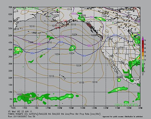
The NOGAPS forecast says the storm will creep through Korea and Japan. It will bring rains to southern Japan. June 27. 2011.
Share this PostPin ThisShare on TumblrShare on Google PlusEmail This

Two Storms, Six-W (Philippine Sea) And Beatriz (East Pacific): Where Will They Go?

Thing are hotting up. Though not in the much vaunted Atlantic Ocean. The Pacific Ocean is the active one this year. Just a few days before it threw up Adrian. Now Beatriz is taking shape. Beatriz is going to nudge closer to the Mexican coast than Adrian did.

The other hot spot is the Philippine Sea. Tropical storm Six-W is brewing out there.

BEATRIZ

The storm has taken shape south of the town of Chilpancingo. It is expected to move north-westward and go near the coast of Colima and then start moving west into the ocean. By June 22, Wednesday, 2011 it will have weakened and breathed its last. Strangely Guatemala and El Salvador will get a drenching on Monday and Tuesday. The Mexican coast in contrast will get occasional drizzles.


BEATRIZ'S PATH

 Monday morning. June 20 2011. Beatriz hovers south of Chilpancingo

 Tuesday June 21, 2011. Beatriz moves closer to the coast as it moves north west. Near Colima. But it has weakened.

Wednesday June 22, 2011. Beatriz has moved westward and is in its death throes

SIX-W

Six-W now stands in the Philippine Sea. JTWC thinks it is going to move into the Chinese mainland and then gradually dissipate. 

JTWC thinks Six-W will enter China.


Share this PostPin ThisShare on TumblrShare on Google PlusEmail This

Depression In Bay Of Bengal Will Move Westwards To Madhya Pradesh Over The Week


This is what the Indian Met Department says of the depression (deep depression) that has formed in the Bay of Bengal.

Dated: 17.06.2011
Sub: Deep depression over Gangetic West Bengal and adjoining Bangladesh.
The deep depression over Gangetic West Bengal and adjoining Bangladesh remained practically stationary and lay centred over Gangetic West Bengal and adjoining Bangladesh at 0530 hrs IST of today, the 17 June 2011, near lat. 22.50 N and long. 89.00 E, about 130 km northeast of Sagar Island, 80 km east of Kolkata and 150 km west-northwest of Khepupara (Bangladesh). The system is likely to move north-northwestwards initially and then west-northwestwards and weaken gradually into a depression during next 24 hours.
Under its influence, rain/thundershowers at most places with heavy to very heavy falls at a few places would occur over north Orissa, Jharkhand and coastal districts of West Bengal during next 48 hours. Isolated extremely heavy falls (25 cm) would also occur over north Orissa during the same period. Rainfall at most places with isolated heavy to very heavy falls would occur over south Orissa, Chhattisgarh and remaining parts of Gangetic West Bengal during next 48 hours.
Squally winds with speed reaching 45-55 kmph gusting to 65 kmph would occur along and off north Orissa and West Bengal coasts during next 12 hours. Sea condition will be rough to very rough along and off these coasts. Fishermen are advised not to venture into the Sea off these coasts during next 12 hours.
The system is under constant watch and concerned state Govts are being informed accordingly.

This is the first depression/low pressure area that has formed in the Bay of Bengal. One may note that the early low pressure areas in the Bay of Bengal move westward (Towards western states of India). But as the monsoons progress, they start shifting to a north-westerly and a northerly direction (moving towards Uttar Pradesh and Bihar).


This particular storm is going to bring a lot of rainfall to many states in India, starting with Bengal,Orissa, Bihar, Jharkhand, Chattisgadh, Madhya Pradesh, parts of Maharashtra and then some precipitation in Gujarat! A busy guy! But the rain system will reach Gujarat (a very weak system by that time) after a week. It will traverse India east to west in one week.

PREDICTED PATH OF THE LOW PRESSURE AREA


The present.June 17, 2011. Friday. The storm is drenching Orissa, Bengal and parts of Bihar

Saturday (June 18, 2011) evening IST. The storm has moved north-westerly towards Bihar. But it will swing direction again soon and head west for Gujarat

June 19, 2011. Sunday (IST) early morning. The rains have arrived in eastern Madhya Pradesh.

Monday (June 20, 2011) evening.The low-pressure area barrels along Madhya Pradesh

Friday.June 24, 2011. The rain system comes to Gujarat. A long journey!


Share this PostPin ThisShare on TumblrShare on Google PlusEmail This

Heavy Rains Coming To South Eastern United States From June 25, 2011

Though the Pacific has thrown up Adrian and forecasts say another storm ( a weak one) is brewing up there, the Atlantic Ocean sits benign till now. But there is much rain in store for southern and south-eastern US from June 25, 2011. The states affected will be Louisiana, Mississippi, Alabama, Georgia, South Carolina and North Carolina. The rains will start from Louisiana and then move along the states mentioned over the days to come.


The rain system may even move north along the Atlantic coast to New York and Washington DC too. But later that.

THE RAIN PREDICTION MAPS


 June 26, Sunday.The rains move into Louisiana

 June 30, 2011.The entire south-eastern stretch is wet


July 1, 2011. Thes rain hit South and North Carolina
Share this PostPin ThisShare on TumblrShare on Google PlusEmail This

Heavy Rains Forecast For Southern And Central Japan June 15-17, 2011

Japan is going to see a deluge from today, Wednesday (June 15, 2011) for the next two days. Heavy rain-bearing clouds move in from China and the islands of Kyushu,  Shikoku and Honshu islands will bear the brunt. Southern and central Japan. Tokyo will be very wet on Friday (June 17, 2011).

THE RAIN FORECAST MAPS


Wednesday mid-night (UTC Time)

 Thursday (June 16, 2011) noon (UTC)

Thursday evening, June 16, 2011 (UTC)
Share this PostPin ThisShare on TumblrShare on Google PlusEmail This

Arabian Sea Tropical Storm Will Die Within 24 Hours.


The tropical storm over the Arabian Sea now lies at 20.4N 71.0E. It is 345 nautical miles south-east of Karachi. It is at the Saurashtra coast near Diu. It will weaken rapidly and dissipate by tomorrow (Monday, June 13, 2011). It will die by the Saurashtra coast and not expected to travel any further. Yes, the remnants of the storm may half-heartedly drift up to the Kutch coast till Tuesday (June 14, 2011).


FORECAST AND COMMENTS

  • The cyclone will die by tomorrow (Monday, June 13, 2011) moning near Porbandar on the Saurashtra (India) coast
  • There will be lots of wind throughout Saurashtra, especially the coastal towns of Diu, Veraval and Porbandar.
  • Very heavy rain is forecast in Veraval and Porbandar. My guess? 10 inches. That is a lot of precipitation!
  • The rest of Saurashtra and Kutch too will get some rainfall.
Heavy downpour expected in Veraval and Porbandar till Monday (June 13, 2011)


THE FINAL WORD ON THE STORM
The last bulletin by the Pakistan Met. Department perhaps closes the chapter of the Arabian Sea tropical storm (why was it never christened as "Keila"? Too short-lasting?)


Heavy rains lashed Verval on June 12, 2011 owing to the influence of the tropical storm


POSTSCRIPT (Storm 1A never got christened as "Keila")


North Indian (forecast track charts for Global and South Asia models shown)
Name & IDStart & end dates1-/10-minute MSWComments on Met Office global model forecasts
01A11-12 June35/30 knots01A only briefly reached tropical storm status according to JTWC.
Share this PostPin ThisShare on TumblrShare on Google PlusEmail This

Keila Is Coming Today! Will Hit Pakistan Coast Monday (June 13, 2011) Evening


Keila Is Coming! Finally! She will awake from her 'hibernation', gain strength and hit the Saurashtra coast by today (Saturday, June 11, 2011) evening. Keila will be a little girl. A cyclone with wind speeds of 80+ Kmph. Though she might have her nasty spells. 


Contrary to earlier predictions Keila is going to enter the Saurashtra coast more then expected before. It is also going to hit the area around Karachi (Monday, June 13, 2011) evening bang on. It will then peter out  Wednesday (June 15, 2011) near the Pakistan coast (Gwadar area).


The dampener is that another prediction model, EFS says the low pressure area in the Arabian Sea is going to fizzle out soon. Not even touch the Saurshtra coast. The forecast in this article is based on the GFS model. I generally prefer the GFS. EFS, I feel, is too timid at times.


LATEST JTWC BULLETIN

THE AREA OF CONVECTION PREVIOUSLY LOCATED NEAR 18.4N
70.2E, IS NOW LOCATED NEAR 19.2N 71.2E, APPROXIMATELY 95 NM WEST OF
MUMBAI, INDIA. ....THE LLCC IS CURRENTLY DRIFTING TO THE NORTHEAST. MAXIMUM SUSTAINED SURFACE WINDS ARE ESTIMATED AT 28 TO 33 KNOTS. MINIMUM SEA LEVEL PRESSURE IS ESTIMATED TO BE NEAR 999 MB. THE POTENTIAL FOR THE DEVELOPMENT OF A
SIGNIFICANT TROPICAL CYCLONE WITHIN THE NEXT 24 HOURS REMAINS HIGH.

ARABIAN SEA CYCLONE LATEST XTREME FORECASTS

  • Keila will touch the Saurashtra coast today (Saturday, June 11, 2011) evening near the Diu-Veraval stretch.
  • The coastal towns of Diu, Veraval, Pobandar, Dwarka, Kandla, Mundra, Mandvi will see high speed winds. 80+ Kmph. Interior Saurashtra will have lower winds. 50+ Kmph.
  • Keila will hit the Pakistan coast on Monday (June 13, 2011). Including Karachi.High speed winds of 80+ Kmph.
  • The storm will subside on Wednesday near Gwadar.
  • Heavy showers are expected on the coastal areas of Saurashtra and in Karachi.
EXPECTED PATH OF CYCLONE KEILA


 Saturday Night. June 11, 2011. Keila touches Saurashtra coast

 Monday (June 13, 2011) Keila passes Kutch.

 Tuesday (June 14, 2011) morning (Local time). Keila reaches Karachi

Wednesday (June 15, 2011) evening. End of Keila near Gwadar.
Share this PostPin ThisShare on TumblrShare on Google PlusEmail This

Lots Of Rain In Kyushu Island, JAPAN Sunday, June 12, 2011

JAPAN
Southern Japan. Islands of Kyushu and Shikoku and Tokyo too are in for a lot of rains in the next three days. ESPECIALLY ON SUNDAY. JUNE 12, 2011. Rains clouds stream from China keeping these places wet. Lots of rain in the three days. 20 cm. Then another wet spell comes on June 15. Yeah! Lots of rains in southern Japan likely over the next week.


This is only for 24 hours on Saturday ( June 11, 2011) Imagine the total rain in three days!


AND IT HAPPENED.....


Sunday, June 12, 2011


Heavy rain pelts much of Japan
Kyodo
Rain soaked much of Japan on Saturday, triggering warnings of mudslides, floods, lightning and tornadoes from the Meteorological Agency, which said the downpours could continue through Sunday.

The rain suspended service on the Tokaido Shinkansen Line connecting Tokyo and Osaka on Saturday morning, causing delays of up to 38 minutes for 33 bullet trains passing through Shizuoka Prefecture.

Parts of southwestern, western and central Japan experienced heavy rainfall, recording 78 mm between 9 a.m. and 10 a.m. in Kumamoto Prefecture, while some areas in Wakayama, Kochi, Kumamoto, Miyazaki and Kagoshima prefectures had more than 250 mm of rainfall in the 24 hours leading to Saturday morning.


--------------------------------------


(Mainichi Japan) June 12, 2011

Heavy rain falls in southwestern Japan, 1 missing in Kagoshima

TOKYO (Kyodo) -- Heavy rain triggered by an active rain front and low pressure system continued to fall in the Kyushu region in southwestern Japan on Sunday, leaving a man missing in Kagoshima Prefecture and leading a local government in Kumamoto Prefecture to briefly recommend residents to evacuate.

The Japan Meteorological Agency continued to warn of mudslides and flooding, as heavy rain is expected to fall intermittently on parts of the archipelago's western half through early Monday.

In the city of Satsumasendai in Kagoshima Prefecture, Mutsuo Arimura, a 78-year-old farmer, went missing after he went to his rice fields near his home on Saturday, the police said Sunday.

A series of landslides occurred in Nagasaki Prefecture, leaving a firefighter injured while he was helping local residents to sandbag their homes in the city of Unzen on Sunday.

Meanwhile, the Kumamoto city government in Kumamoto Prefecture issued a recommendation for residents living near rivers and hills to evacuate, warning of mudslides and flooding.

After a wide range of areas experienced downpours Saturday, a low pressure system that developed into a rain front over the East China Sea passed over the Kyushu region in southwestern Japan and is expected to move toward the Izu island chain south of Tokyo around daybreak Monday, the agency said.

JR Kyushu said, due to heavy rain, it has suspended services on the Kyushu Shinkansen bullet train line between Shintamana Station in Tamana and Kumamoto Station, both in Kumamoto Prefecture. Services are also suspended between Shinyachiyo Station in Yachiyo, Kumamoto Prefecture, and Izumi Station in Izumi, Kagoshima Prefecture.

The Pacific side of southwestern to western Japan is likely to see heavy rainfall of between 50 to 70 millimeters per hour, and the weather agency said heightened vigilance is required, particularly in Kyushu where large amounts of rain also fell Saturday.

Around 200 mm of rainfall is forecast to fall in southern Kyushu and 150 mm in Shikoku and the Kinki region in the 24 hours to 6 p.m. Monday.


Share this PostPin ThisShare on TumblrShare on Google PlusEmail This

Keila Taking Her Time. Will Touch Saurashtra Saturday Noon

Keila is a lazy girl.She has been sitting and brooding off the coast of Mumbai since many days. It has led to many of us from losing interest in her. Lazy girl. But JTWC (Joint Typhoon Warning Center) thinks otherwise. Keila is going to move  and grow big. She is expected to touch Saurashtra coast by Saturday (June 11, 2011) noon.


She will potter around Saurashtra till Monday (June 13, 2011) and then rapidly intensify, flirt with the Pakistani coast and then move along in the sea and then suddenly collapse Wednesday noon. Baluchistan will not fall to the charms of Keila. But coastal Saurashtra-Kutch and Sind will see big gusts of wind. 70+Kmph.


Rains? Some rains in coastal Saurashtra and Sind.


Keila will never turn into a big bad girl like Katrina. She will remain a little girl. But who knows?


Keila will be at her strongest when she leaves Indian shores.


Ironically Keila's remnants might bring some rain to Oman after all.On Wednesday. June 15, 2011

 Keila will touch Saurashtra coast by Saturday (June11, 2011) noon. As a depression perhaps?

Keila will be strongest on Tuesday (June 14, 2011) morning. Before she dissipates soon after.


Keila disintegrates. Wednesday June 15, 2011
Share this PostPin ThisShare on TumblrShare on Google PlusEmail This

Latest JTWC News On Arabian Sea Storm


LATEST BULLETIN FROM JTWC (JOINT TYPHOON WARNING CENTER)

FORMATION OF A SIGNIFICANT TROPICAL CYCLONE IS POSSIBLE WITHIN
A 120 NM RADIUS OF 18.4N 70.3E WITHIN THE NEXT 12 TO 24 HOURS.

DUE TO CONTINUED FAVORABLE ENVIRONMENTAL CONDITIONS, THE POTENTIAL FOR THE DEVELOPMENT OF A SIGNIFICANT TROPICAL CYCLONE WITHIN THE NEXT 24
HOURS REMAINS HIGH.


Share this PostPin ThisShare on TumblrShare on Google PlusEmail This

Tropical Storm To Hit Saurashtra Friday (June 10, 2011) Noon.


The present low pressure area in the Arabian Sea is likely to move north towards the Saurashtra coast and turn into a deep depression by the time it touches Diu at the southern tip of the peninsula. It will continue as a depression during the following two days as it moves along the coastal areas. By Sunday (June 12, 2011) it will  intensify rapidly into a cyclone. It will be leaving Gujarat waters by then. I guess it will be christened as "Keila" then. It will skim coastal Pakistan till Tuesday (June 14, 2011) when it will make landfall at Gwadar, near the Pakistan-southern Iran border. It will dissipate soon after.


WHAT THE JTWC SAYS (LATEST)


FORMATION OF A SIGNIFICANT TROPICAL CYCLONE IS POSSIBLE WITHIN
A 160 NM RADIUS OF 18.7N 69.8E WITHIN THE NEXT 12 TO 24 HOURS.
AVAILABLE DATA DOES NOT JUSTIFY ISSUANCE OF NUMBERED TROPICAL CY-
CLONE WARNINGS AT THIS TIME.
THE POTENTIAL FOR THE DEVELOPMENT OF A SIGNIFICANT TROPICAL CYCLONE 
WITHIN THE NEXT 24 HOURS IS UPGRADED TO HIGH. 
LATEST ARABIAN SEA TROPICAL STORM FORECAST
  • The low pressure presently standing stationary west of Mumbai will slowly start moving north. By the time it touches the Saurashtra (India) coast Friday (June 10, 2011) morning it will have turned into a deep depression.
  • It will move along the Saurashtra coast for the next two days. By Sunday (June 12, 2011) when it leaves Indian waters near Dwarka, it will intensify rapidly into a cyclone.
  • This cyclone, which will be named "Keila", will skim along the Pakistani coast and only make landfall at Gwadar in Balochistan om June 14, Tuesday. After which it will dissipate on the Balochistan-southern Iran border.
  • All the coastal towns in India; Diu, Verval, Porbandar, Dwarka and Karachi in Pakistan will see high speed winds. 80+Kmph.
  • Fishermen in both Gujarat and Sindh are warned not to venture into the sea from Friday (June 10, 2011) to Tuesday (June 14, 2011). The storm will mostly be moving in the sea so the winds there will be much more than the land areas. Wind speeds in the seas near the Gujarat and Sindh coast will be very high. 150+ Kmph.
PREDICTED PATH OF THE STORM
 Friday noon. Tropical depression touches the Saurashtra coast
 Saturday (June 11, 2011) morning. Depression weakens a little and moves along the coast
 Sunday (June 12, 2011) late night. Keila gains strength rapidly
 Tuesday (June 14, 2011) noon. Keila hits Gwadar
Wednesday night (June 15, 2011) The end of Keila.
Share this PostPin ThisShare on TumblrShare on Google PlusEmail This

Cyclone Keila To Form Today, Will Touch Saurashtra Coast Friday Morning

Let me tell you how cyclones are born. They start off as a low pressure area. Then they get stronger and develop in a depression. Then intensify into a deep depression. If it gains further strength, a cyclone is born. It are also called a hurricane,  typhoon or a severe tropical storm.

Keila has taken birth. It is a low pressure area now. It lies now at 18.7N 69.8E . It is 180 miles west of Mumbai. She is expected to grow bigger and stronger into a depression and start moving north towards the Saurashtra coast. By the time it reaches Diu (Friday June 10 morning) on the southern tip of the Saurashtra peninsula it will have turned into a cyclone. Albeit a small cyclone. Windspeeds of 80 Kmph. Keila will then move along the Saurashtra coast till Saturday (June 11, 2011) evening. It is when it leaves Saurashtra (Saturday morning) that the storm will rapidly gather strength. Turn bigger with wind speeds of 120+ Kmph. Keila's periphery will touch Karachi and she will move into Baluchistan (Gwadar) Tuesday  June 14 morning. Gwadar will face the most fury of the cyclone.


June 9, 2011 Thursday 06.15 AM (GMT,UTC)


THE AREA OF CONVECTION PREVIOUSLY LOCATED NEAR 19.1N  69.7E, IS NOW LOCATED NEAR 18.7N 69.8E, APPROXIMATELY 180 NM WEST OF MUMBAI, INDIA.
DUE TO DECREASING PRESSURES, PERSISTENT DEEP  CONVECTION, AND INCREASINGLY FAVORABLE ENVIRONMENTAL CONDITIONS, THE POTENTIAL FOR THE DEVELOPMENT OF A SIGNIFICANT TROPICAL CYCLONE WITHIN THE NEXT 24 HOURS IS UPGRADED TO HIGH.

ARABIAN SEA TROPICAL STORM LATEST FORECAST

  • Keila (If I may call the lady so now) is going to intensify today and start moving north. It will touch the Saurashtra coast by Friday (June 10, 2011) morning. She will weaken a little as she meets Saurashtra.
  • She will move along the Saurashtra coast till Sunday (June 12, 2011) morning. Then as leaves Indian waters it will rapidly gain strength and turn into a big cyclone. Keila's edges will touch Karachi (Deadly touch!).
  • Keila will hit Baluchistan, especially Gwadar, Tuesday, June 14, 2011, morning. And hit it really hard. Wind speeds in excess of 150+ Kmph.
  • It will dissipate by Wednesday (June 15, 2011) evening over southern Iran
  • In India the Saurashtra towns of Diu, Veraval, Porbandar, Dwarka will see the most of Keila. Dwarka especially will be severely hit. All of Saurashtra - Kutch will have winds of 70-80 Kmph.
  • Saurashtra - Kutch will receive continuous rains (heavy falls) till Monday. Especially the coastal areas.
  • Southern Sind and Baluchistan will get lots of rain from Sunday (June 12, 2011) to Wednesday (June 15, 2011) evening. By rain I mean downpour. We are talking of 5, 10, 15 inches here. Lots of rain.
Lots of rain in the next one week in the coastal areas of Gujarat, Sind, and Balochistan
    THE LATEST PREDICTED PATH OF KEILA
     FRIDAY (JUNE10, 2011) KEILA SAYS HELLO TO SAURASHTRA. ESPECIALLY DIU.
     FRIDAY NIGHT. A WEAKENED KEILA POTTERS AROUND THE SAURASHTRA COAST
     SUNDAY MORNING. JUNE 12, 2011. KEILA GATHERS STRENGTH AS SHE LEAVES THE GUJARAT COAST
     MONDAY (JUNE 13, 2011) EVENING (PAKISTAN TIME) KEILA ABOUT TO ENTER PAKISTAN
     TUESDAY EVENING. KEILA MAKES LANDFALL INTO BALOCHISTAN
    WEDNESDAY (JUNE 15, 2011) MORNING. END OF THE STORM IN SOUTHERN IRAN
      Share this PostPin ThisShare on TumblrShare on Google PlusEmail This

      Latest Forecasts/Updates


      Popular Posts

      Search This Site