I hesitate to write these words. Weather is so fickle. I looked very stupid when I predicted a tropical storm in the Bay of Bengal in the end of the April. But it all fizzled out and neither Bengal, nor Bangladesh nor Myanmar received any rains or whiff of a storm.
But I dare make a prediction again. Heavy rains with strong winds around the 7th of June, 2012 either in Gujarat (India) or Oman.
I say this after looking at the big mass of clouds that have formed near the Horn of Africa. In the coming days that system is going to intensify into a low pressure area and move north-west in the Arabian Sea.
 |
| NOW. The map shows the mass of clouds near the Somalian coast. These will move upwards into the Arabian Sea.
When? The mass of clouds will slowly move into the Arabian Sea in the next few days and become a low pressure area by the 2nd of June, 2012. the location then will be 14 degrees North and 62 degrees East.
|
 |
| June 2, 2012. The system has become a low pressure area.Location 1000 Km east of the Maldives. Due to its influence there will be rains in Saurashtra and Mumbai on June 4, 2012. |
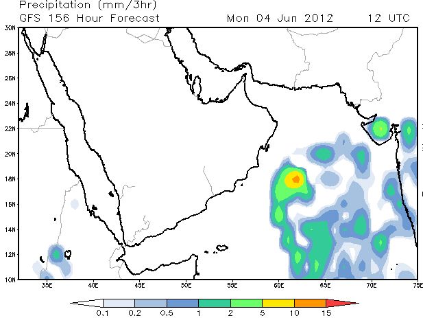 |
| June 4, 2012. Rains in Saurashtra and Mumbai
The question is where will be the rain system go? Towards Gujarat or Oman. On June 5 it has shifted a bit westwards; towards Oman. But it is early days to be sure. My hunch says it will head to Gujarat around June 10, 2012.
 |
 |
June 5, 2012. Where will the low pressure area go? It has shifted slightly westward. Will it move to Oman? |


