AUGUST 12, 2016, FRIDAY
After Gujarat, Rajasthan and West Bengal the monsoon focus is on Chattisgarh. Then Madhya Pradesh faces incredibly a week of continuous rain till August 18. Meanwhile as the Rajasthan cyclonic circulation is in its death throes, rains over Delhi, Haryana will lessen, then stop.
The circulation that was formerly a low pressure area over West Bengal lies over Bihar-Jharkhand. This system will move to Chattisgarh and then hover over northeast Madhya Pradesh causing dangerous flooding precipitation in parts of the state for a week. Another low pressure area which will creep in from the Bay of Bengal on August 15-16 will add to the state's misery.
Forecast models are also hinting at the possibility of a cyclonic circulation forming over western Madhya Pradesh-southern Rajasthan on August 20-21, hence bringing another spell of rains to Rajasthan, Gujarat and possibly Sindh.
The GFS model begs to differ. It predicts a Bay of Bengal low pressure area forming on August 20-21 , moving through Andhra, Telangana onto Maharashtra, Gujarat on August 23. It expects another Bay of Bengal low hitting Gujarat on August 28-29. But one should be sceptical as GFS forecasts change rapidly at times.
Very heavy rains in northern Chattisgarh (Ambikapuram, Surajpur) northeastern Madhya Pradesh (Singrauli, Rewa) till Saturday morning.
Heavy rains in northeast Madhya Pradesh (Katni, Jabalpur) on Saturday. Rains will spread to other parts of the state (Omkareshwar, Itarsi) on Sunday.
HEAVY FLOODING RAINS IN EASTERN MADHYA PRADESH ( Jabalpur, Damoh, Katni belt) TILL AUGUST 19, 2016.
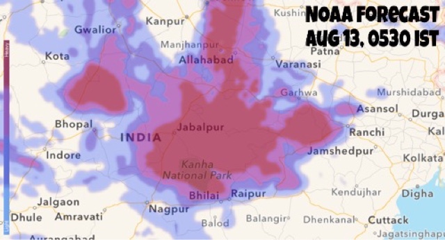
This rain radar image taken at 0630 hours IST shows the cyclonic circulation bringing heavy rains to Chattisgarh, northeastern Madhya Pradesh and parts of eastern Uttar Pradesh.
NOAA FORECAST MAPS


1 comment:
Sir What About Salala Oman! Monsoon Come Down Last 2 Day!
Post a Comment