Update: 0500 HRS GMT, December 11, 2014
 Tropical Storm Hagupit is intensifying now.
Right now it is spewing winds of 70 kph. Presently it lies about 500 kms east of central Vietnam. Contrary to what the JTWC predicts, this storm is intensifying again. It will grow stronger till it hits the Vietnamese coast early hours of Friday (Vietnam Time). At landfall the winds will be about 80-90 kph. Heavy rains are likely in central Vietnam in the next two days. (See Forecast map on right).
In fact, central Vietnam is going to see a lot of rain in the coming 10-12 days. First Hagupit and then another depression that will move in after a week. Parts of central Vietnam will face up to 25 inches of rain. Flooding, perhaps?
See the storm LIVE
See Rain Forecast Maps
------------------------------------------------
DO NOT WRITE OFF HAGUPIT...YET
Update: 0600 HRS GMT, December 10, 2014
WILL INTENSIFY AGAIN IN NEXT 12 HOURS
Update: 0630 Hours GMT. December 9, 2014
DO NOT WRITE OFF HAGUPIT...YET
Update: 0600 HRS GMT, December 10, 2014
The JTWC had almost washed its hands off Hagupit. Until it intensified again. Presently it lies about 700 kms east of central Vietnam and is throwing out winds of 75 kph. By tomorrow evening (Vietnam Time) it will make landfall at either Binh Thuan or Ninh Thuan province. Though winds will be sub-cyclone speeds it will be still 55 kph, gusts up to 75 kph. heavy rains are expected in central and southern Vietnam.
------------------------------------------------WILL INTENSIFY AGAIN IN NEXT 12 HOURS
Update: 0630 Hours GMT. December 9, 2014
Tropical Storm Hagupit is going to intensify again.
Hagupit is going to intensify in the coming 12 hours. It may weaken a bit after that but by the time it hits central Vietnam on Thursday night (Vietnam Time) it will be throwing winds of 90 kph. Some other forecasts even hint at the possibility of it going through Vietnam, Thailand and reaching the Indian coast as a depression. Phew! A long way to travel.
See Hagupit Track
But Vietnam is facing a cyclone threat in the coming 72 hours, is certain.
There is a strong possibility that the country may be hit by another tropical storm (JANGMI) on December 15-16. But that is dealt with elsewhere.
See Hagupit Track
But Vietnam is facing a cyclone threat in the coming 72 hours, is certain.
There is a strong possibility that the country may be hit by another tropical storm (JANGMI) on December 15-16. But that is dealt with elsewhere.
------------------------------------------------
HEAVY RAINFALL HAVE STARTED IN MANILA
Update: 1330 hours GMT, December 8, 2014
See animated satellite images of its recent movement HERE
-------------------------------------------------
HEAVY RAINS IN MANILA TODAY
Update: 0330 Hours, GMT, December 8, 2013
-------------------------------------------------
RAINS STILL A THREAT
Update: 1400 Hrs GMT, December 7, 2013
--------------------------------------------------
 The storm has travelled the Samar Island and is about to leave it. It has weakened a little but still has 170 kph winds. It will now move to Legazpi city and Masbate Island.
---------------------------------------------------
THE 'EYE' HAS HIT PHILIPPINES AT SAMAR (BETWEEN BORONGON AND TAFT)
--------------------------------------------------
THE STORM HAS HARDLY MOVED IN THE LAST 3 HOURS: TYPHOON JANGMI AFTER HAGUPIT?
Update: 1000 hours GMT, December 6, 2014
HAGUPIT'S PERIPHERY IS TOUCHING PHILIPPINES NOW
Update: 0500 Hrs GMT, December 6, 2014
HEAVY RAINFALL HAVE STARTED IN MANILA
Update: 1330 hours GMT, December 8, 2014
The winds are dropping all the time. In fact it is hardly windy in Manila city. The eastern coast of Luzon has strong winds of 75 kph. But it is raining hard in many parts of Luzon. Next 12 hours will see very heavy rains in Manila and Quezon City
It rained heavily in Batangas, Lucena, Tayabas city in the last one hour. It rained heavily in Mindoro a few hours ago. The rains are shifting north now.
The storm is over Lucena now, 120 kms south-east of Manila City. In a few hours it will pass closest from the city between Calamba and Lipa. Another 6 hours after that and it will leave Filipino shores.
The worry of flooding in Manila is real.The memories of the flood of September 28, 2009 are still fresh. The heavy rains caused by typhoon Ketsana led to inundation of the metro and 246 people had died. Four-fifths of the city had been submerged under water. Thousands had been displaced.
-------------------------------------------------
HEAVY RAINS IN MANILA TODAY
Update: 0330 Hours, GMT, December 8, 2013
The storm is weakening all the time as it moves over the Philippines land mass, Winds have dropped to 100 kph, but the rains continue. Manila is for a thorough drenching in the next 24 hours. The areas of southern Luzon and southern Tagalog (Mindoro) will get the maximum rains.


Hagupit knocking on Manila's door
-------------------------------------------------
RAINS STILL A THREAT
Update: 1400 Hrs GMT, December 7, 2013
The winds are dropping all the time but the JTWC predicts that tomorrow night (Philippines Time) when Hagupit will be passing south of Manila the winds will still be about 120 kph. Presently the storm is near Masbate city with winds of 140 kph. The problem is not the winds but that the slow moving storm is dumping lots of rain on the country. It is going to take 36 hours before it exits Philippines shores.
By the time it reaches southern Vietnam on December 12, it will be below tropical storm strength, just a depression
--------------------------------------------------
HAGUPIT TYPHOON NOW LEAVING SAMAR ISLAND Update: 0330 hours, December 7, 2014
 The storm has travelled the Samar Island and is about to leave it. It has weakened a little but still has 170 kph winds. It will now move to Legazpi city and Masbate Island.
According to the JTWC it will take another two days to move through Philippines. When it moves close to Manila tomorrow evening (local time), the winds will be still 120-150 kph.
Hagupit will weaken considerably when it leaves Philippines on Tuesday but it will strengthen a little when it enters the South China Sea. It will then go on to hit southern Vietnam on Friday (December 11, 2014) morning (Vietnam Time). But it just be a weak storm. Winds of 65-85 kph
See Latest Track Forecast MapHagupit Will Go To Vietnam Too
Hagupit will weaken considerably when it leaves Philippines on Tuesday but it will strengthen a little when it enters the South China Sea. It will then go on to hit southern Vietnam on Friday (December 11, 2014) morning (Vietnam Time). But it just be a weak storm. Winds of 65-85 kph
---------------------------------------------------
THE 'EYE' HAS HIT PHILIPPINES AT SAMAR (BETWEEN BORONGON AND TAFT)
Update: 1400 Hrs, December 6, 2014
Typhoon Hagupit has hit Philippines at Samar Island between Borongon City and Taft. The landfall happened slightly south than was earlier expected. Ground Zero is 100 kms NE of Tacloban. The storm had winds of 200 kph, gusts to 250 kph on impact.
When the eye will pass through Samar island the winds will drop dramatically. The rains may cease or turn into a drizzle. But this will be a period of deceptive calm. Within a hour the howling will start again as the other half of the diameter will pass. Samar is in for a good hiding tonight. It is already facing very strong winds and drenching rains.
The storm will pack winds of 140-165 kph even on Monday-Tuesday as it leaves Philippines. A powerful storm.
The storm will pack winds of 140-165 kph even on Monday-Tuesday as it leaves Philippines. A powerful storm.
THE STORM HAS HARDLY MOVED IN THE LAST 3 HOURS: TYPHOON JANGMI AFTER HAGUPIT?
Update: 1000 hours GMT, December 6, 2014
It seems as if it was deciding which direction to go to. Searching for conditions which will favor it. Yes. Typhoon Hagupit has remained almost stationary in the last 3 hours.
Forecast models mostly say it will make landfall at north Samar tonight (or early morning tomorrow). Winds at time of impact will be about 185 kph. It will then move though Bicol and then on to Mindoro and Luzon over the next 2-3 days. The city of Legazpi will face a direct hit.
Because it is slow moving it will throw down more precipitation and expose the country to strong winds for a longer period.
Already a part of the diameter of the storm has already entered Philippines.
Another piece of bad news for Philippines. Latest GFS forecasts indicate of another typhoon hitting the country around December 14, 2014. Typhoon JANGMI will be smaller than Hagupit but one storm after another in a few days! The mind boggles.
--------------------------------------------------Forecast models mostly say it will make landfall at north Samar tonight (or early morning tomorrow). Winds at time of impact will be about 185 kph. It will then move though Bicol and then on to Mindoro and Luzon over the next 2-3 days. The city of Legazpi will face a direct hit.
Because it is slow moving it will throw down more precipitation and expose the country to strong winds for a longer period.
Already a part of the diameter of the storm has already entered Philippines.
Another piece of bad news for Philippines. Latest GFS forecasts indicate of another typhoon hitting the country around December 14, 2014. Typhoon JANGMI will be smaller than Hagupit but one storm after another in a few days! The mind boggles.
HAGUPIT'S PERIPHERY IS TOUCHING PHILIPPINES NOW
Update: 0500 Hrs GMT, December 6, 2014
Right now Typhoon Hagupit's outer boundary is touching Samar Island. Wind speed is 210 kph, gusts up to 260 kph. The storm is weakening.
Most forecasts say that the storm will curve slightly upwards. The worst affected areas will be Samar, Bicol, Tagalog. The typhoon will move over these areas in the next 48 hours. The wind speeds will gradually decrease as it does so. But Manila will have 140 kph winds on Monday when Hagupit reaches it.
See the video below to know where and when will it rain as the storm moves through the Philippines. The forecast is valid from Saturday (December 6, 2014) to Tuesday (December 9, 2014)
VIDEO: Rain Forecast Owing to Hagupit (Saturday to Tuesday)
----------------------------------------------------See the video below to know where and when will it rain as the storm moves through the Philippines. The forecast is valid from Saturday (December 6, 2014) to Tuesday (December 9, 2014)
VIDEO: Rain Forecast Owing to Hagupit (Saturday to Tuesday)
HAGUPIT TO GROW STRONGER IN NEXT 12 HOURS TO 250 KMPH (GUSTS 300 KMPH)
Update: December 5, 2014: 1430 Hours GMT
The fears of the people of Philippines are well-founded. Typhoon Hagupit had weakened slightly in the last six hours, but latest indications are it is going to intensify even more in the coming 12 hours. 250 Kmph, with gusts up to 300 Kmph. A Category 5 hurricane without doubt.
The only silver lining (If one may say so) is that when the typhoon passes Samar Island Sunday morning winds will drop to 210 Kmph. This is a slow moving storm, which makes it even more lethal. Strong winds for longer periods and more rainfall dumped over an area.
The word "landfall" is for met guys. It means the "eye" of the cyclone moves aver a particular area. For the people who will face the storm it is a technical irrelevancy. The eye of Hagupit is about 300 kms from the Philippines coast of Samar, but the lashing has already started as the periphery of this huge storm has already started moving in.
The latest forecast bulletin by the JTWC issued at 1500 Hrs today (December 5, 2014) predicts the brunt of the storm will be felt in Eastern Visayas, Bikol and Southern Tagalog. A relentless hammering by 200-250 kph winds. Come Monday evening (local time) and Manila will get a direct hit with 130-170 kph winds.
Philippines is in for hard times in the next 72 hours
---------------------------------------------------
HAGUPIT WILL HIT EAST VISAYAS (PHILIPPINES) TOMORROW (LOCAL TIME) WITH 200 KMPH WINDS
Update: December 5, 2014: 0300 Hrs GMT
It is almost certain now that Typhoon Hagupit will enter Philippines at Eastern Visayas tomorrow morning (Philippines Time). The wind speeds then will be 200 Kmph, gusts up to 250 Kmph. The typhoon is weakening from its peak strength yesterday (It is below super typhoon grade now) but it will still be a formidable storm when it hits Philippines tomorrow.
The areas that will be worst affected will be Eastern Visayas, and parts of central Visayas, west Visayas and Bikol. After hitting the country the typhoon is going to move in a NW direction for the next 48 hours. That is the worrying part. The storm is going to move over the country slowly, lingering on till Monday morning. With such winds, in two days, it could wreak havoc.
The worst affected islands will be Samar, Leyte, Bikol, Masbate, Panay and Mindoro.
The worst affected islands will be Samar, Leyte, Bikol, Masbate, Panay and Mindoro.
By the time it exits Philippines from the Mimiropa area it will be considerably weakened. This is the scenario on which the GFS and ECMWF Models agree.
The JTWC predicts a slightly northerly course. Hitting Bikol and then moving through Luzon. According to it, Hagupit will move over Philippines for three days; Till Tuesday. On Tuesday morning Manila will experience 115-140 Kmph winds.
The storm on entering the South China Sea will face the colder waters along the mainland Asian coast and so will not be able to intensify much again. It will move on to Vietnam on December 12, 2014 as a weak storm. Winds of 60-80 Kmph.
At 1200 Hrs GMT yesterday, according to NOAA readings, Hagupit was a Dvorak 8 Hurricane. That is a Category 5 hurricane.
The central pressure at 0600 Hrs GMT, December 5, 2014: 941 Mb. A Big storm, in short. But the central pressure is increasing, a sign that the typhoon is weakening.
---------------------------------------------------
PHILIPPINES WILL BE HIT: POINT AND TIME OF IMPACT: EXPECTED WIND SPEEDS
Update: December 4, 2014: 1500 Hrs GMT
All the forecast models agree. Philippines will be hit on Saturday. The GFS model (along with the JTWC) say now that the country will suffer a direct assault by this monster created by nature. The ECMWF model has been saying all the time that super typhoon Hagupit would hit Philippines.
The models disagree only on the areas of the country which will bear the brunt of the storm.
The GFS says the worst affected will be East Visayas, Bikol and Luzon (Including Manila). The European model predicts a 'Haiyan' path. Piercing through the Visayas (East, Central and Western). That means Tacloban is in for another lashing. In short the GFS (and JTWC) predict northern Philippines will be worst hit. The ECMWF says central Philippines.
In fact, the European model says Hagupit will go on to Vietnam on December 11, 2014. The GFS forecasts its dissipation over northern Philippines.
Time Of Impact will be Saturday morning (December 6, 2014) Philippines time.
Wind speed at impact will be 230 Kmph (Eastern Visaya) gusts up to 280 Kmph. At Bikol the wind will be 215 Kmph, gusting up to 260 Kmph. When it passes by Manila on Monday the winds will be 160 Kmph (Gusts: 200 Kmph).
These are latest estimates (December 4, 2014: 1500 Hrs GMT) by the JTWC, which are generally reliable. If this happnes!
Present location: (December 4, 2014, 1200 Hrs GMT): 11 Degrees North, 131.3 Degrees East.
Present Wind Speed: (December 4, 2014, 1200 Hrs GMT): 280 Kmph (Gusts - 335 Kmph)

1130 GMT: December 4, 2014: Today
---------------------------------------------------
SUPER TYPHOON HAGUPIT HAS WINDS OF 290 KMPH NOW: A CATEGORY 5 HURRICANE
Update: December 4, 2014: 0330 Hrs: GMT
It is Mother Earth at her angriest. Or call it nature gone mad. Massive super typhoon HAGUPIT is howling right now with winds of 290 Kmph. Gusts up to 315 Kmph. And it is going to get worse. The JTWC estimates that by tomorrow the winds will go up to 315 Kmph (sustained winds), gusts up to a mammoth 380 Kmph. These are readings by NOAA.
WHAT DO THE LEADING FORECAST MODELS SAY? AN ANALYSIS
WHAT DO THE LEADING FORECAST MODELS SAY? AN ANALYSIS
The storm lay about 400 Kms NNE of Palau Island at 0000 Hrs GMT today. Latitude: 9.8 N. Longitude: 133.9 E. The storm is moving slowly. By Monday morning it will come near the Philippines at East Visayas, then curve NW and move along the coast at Bikol. Though the eye of the storm will not pass through these areas the periphery will. And this will cause massive destruction. The island of Catanduanes will be badly affected. On Monday it will swing away from the Philippines, move NNE and then dissipate on Wednesday.
Both the JTWC and GFS more or less agree on the above mentioned scenario.
The ECMWF model still begs to differ. It says Hagupit will hit central Philippines on late Friday night (December 5, 2014) Philippines time, and go right through. It will then hit Vietnam on Thursday, December 11. It says Hagupit will weaken slightly when it crosses Philippines but gain strength again in the warm waters of the South China Sea. When it strikes Vietnam, it will be a big bad storm. That is if this forecast is vindicated, two countries are going to face vast devastation.
One does not get a storm like Hagupit frequently. If the JTWC predictions come true I think wind speeds of 380 Kmph is going to feature in the hall of infamous records.
The JMA Model (Japanese Meteorological Agency) largely agrees with the European model. Storm goes through Philippines onto Vietnam.
The US Navy's NAVGEM Model says the super typhoon is going to enter Philippines (At Bikol) on Saturday and then keep hammering north Philippines for three days. A doomsday scenario.
The GEM Model agrees with the NAVGEM; Only that Hagupit will enter Philippines a day later, on Sunday. And that northern Philippines will get a unholy hammering for 2-3 days after that.
 |
| HAGUPIT NEAR PHILIPPINES ON MONDAY |
---------------------------------------------------
EUROPEAN MODEL SAYS HAGUPIT HEADED TO VIETNAM
Update: December 3, 2014: 0930 Hrs GMT
At 0600 hours (GMT) today Hagupit lay 400 Kms East-North-East of Palau (Lat: 8.3 N, Long: 138.6 E). Winds were 100 knots (185 Kmph).
Meanwhile, the latest GFS forecast issued at 0600 hrs (GMT) today maintains Philippines is safe. The typhoon will not make landfall into Philippines. It will change direction on Saturday and move north along the coast. We believe this forecast will be vindicated on Saturday. At least for the sake of Philippines (And Vietnam).
The latest forecast issued by the ECMWF persists with its earlier predictions. It says Hagupit is going to hit central Philippines on Saturday. And then pass through, go into the South China Sea and hit Vietnam on December 11, 2014.
If this really happens Philippines is in for big trouble. Hagupit is slowly turning into a monster cyclone. The devastation that it could wreak upon central Philippines (Tacloban again?) boggles the imagination.
On the other hand the latest from the JTWC (These three really matter when it comes to predicting cyclones: GFS, ECMWF and JTWC) seems to be veering around to what the GFS is saying; That Hagupit will slant north and move along the Filipino coast and not hit it. The track shows a definite curving on Saturday.
---------------------------------------------------
UK METOFFICE SAYS TARGET IS BIKOL, DEC. 9
Update: Dec. 3, 2014. 0600 Hrs GMT
UK METOFFICE SAYS TARGET IS BIKOL, DEC. 9
Update: Dec. 3, 2014. 0600 Hrs GMT
Amongst all the hullabaloo about the American and European forecast models everybody seems to have forgotten about the UKMO model. Yes, the UK Met Office too has its own forecast model and what does it say about the future of super typhoon Hagupit?
It says the storm will near the Philippines and hover around for two or three days then enter the country on December 9 (Tuesday) at Bikol area. It will be quite strong then.
Here is the track of Hagupit by UKMO.
-------------- -------- -------- --------
00UTC 03.12.2014 7.4N 139.7E MODERATE
12UTC 03.12.2014 9.0N 136.8E MODERATE LITTLE CHANGE
00UTC 04.12.2014 10.4N 134.0E STRONG INTENSIFYING SLIGHTLY
12UTC 04.12.2014 11.2N 132.1E STRONG LITTLE CHANGE
00UTC 05.12.2014 11.5N 131.2E STRONG LITTLE CHANGE
12UTC 05.12.2014 11.4N 130.7E STRONG LITTLE CHANGE
00UTC 06.12.2014 11.1N 130.3E STRONG LITTLE CHANGE
12UTC 06.12.2014 11.0N 129.8E STRONG LITTLE CHANGE
00UTC 07.12.2014 10.8N 129.1E STRONG INTENSIFYING SLIGHTLY
12UTC 07.12.2014 11.4N 128.0E STRONG LITTLE CHANGE
00UTC 08.12.2014 12.4N 126.3E STRONG LITTLE CHANGE
12UTC 08.12.2014 12.8N 124.9E STRONG WEAKENING SLIGHTLY
00UTC 09.12.2014 13.0N 123.7E STRONG WEAKENING SLIGHTLY
 |
| SATELLITE IMAGE OF TYPHOON HAGUPIT TAKEN AT 0000 HRS TODAY GMT |
UPDATE: DECEMBER 3, 2014: FORECAST MODELS STILL DIFFER: DANGER TO VIETNAM TOO?
Forecast models still differ as to what will Haupit do next. Will it cross through Philippines and go on to hit Vietnam? Or will it disintegrate near the coast of Philippines? Meanwhile the typhoon grows stronger and creeps closer to Philippines. JTWC opines that in the next 60 hours it will turn into a howling super typhoon with winds gusting up to a staggering 300 Kmph.
Typhoon HAGUPIT lay 1000 Kms from the Philippines coast, 450 Kms east of Palau Island at 0000 Hrs GMT today. Wind speed is about 170 Kmph. It is moving in a WNW direction. In the next 48 hours it will intensify rapidly to a super typhoon with speed of 240 Kmph, gusting up to 300 Kmph.
By Friday-Saturday midnight (Philippines time) it will be 450 Kms east of East Visaya. It will at its strongest then. Winds of 240 Kmph.
After that, what? There is a sharp difference on that.
One forecast model (GFS) says it will start curving north and move along the Philippines coast for the next three days. It further says it will dissipate rapidly on December 9 near north Philippines Cagayan region.
The European Model (ECMWF) says the typhoon will hit central Philippines on December 5-6 and move through it (East, Central, West Visayas, Palawan), It will cross over to the South China Sea and go on and strike central Vietnam on December 9, 2014.
Both the models agree on the intensity of the storm. Both say the central pressure will be about 955 mb.
 |
| HAGUPIT TYPHOON 2014: PREDICTED TRACKS/PATH |
SPECIAL UPDATE: DECEMBER 2, 2014: GFS MODEL STILL SAYS HAGUPIT WILL HOVER AROUND PHILIPPINES THEN MOVE NORTH
The GFS forecast modal (Also the Special GFS Model) in its latest predictions still maintains that Philippines will be safe. Typhoon Hagupit will come near the coast of the country on late Saturday, hover around and move north. It will not hit Philippines. It will coast along the Philippines shores, dangerously close, for 48 hours, till Monday then move north.
Everybody is confused. The GFS forecast model says Typhoon Hagupit will not make landfall in Philippines but steer north. The European ECMWF model's latest bulletin says the storm will hit central Philippines on Saturday night. It further says it will cross the country and then move over to Vietnam on December 10, 2014. The JTWC is playing it safe and not taking any position. There are other models like the GEM, CMC, and NAVGEM but we have seen from experience that they are not so reliable. And we do not want to waste your time by going into educational intricacies.
We tend to be partial to the GFS forecast model and so have said that Philippines will remain safe from the monster of a storm. The JTWC predicts Hagupit will be a super typhoon with speeds of 240 Kmph gusting up to a massive 300 Kmph on Sunday (Dec 6, Philippines time) morning.
Scary.
The American model says the typhoon will not hit Philippines. The European forecast model in its last bulletin said that it would hit Philippines and then go onto Vietnam. We await the latest news from the European model. We shall inform you as soon as we get any sort of information.
Typhoon Hagupit lies at latitude 5.9 N, longitude 147 E, about 900 kms south of Guam. In the next days it is going to intensify rapidly. On Friday (December 5) night (Philippines Time) it will be 550 Kms from Eastern Visayas. Winds will be 195 Kmph gusting up to 230 Kmph.
After December 5, 2014, the storm will start curving northwards. It will not hit Philippines, but in the next two days it will move along the coast, a few hundred kilometers far.
By December 9-10 it will start dissipating rapidly as it meets the colder waters near the coast of Japan.
The island of Yap will face the fury of Hagupit tomorrow night with 155-195 Kmph winds.
 |
| LATEST GFS TRACK OF HAGUPIT TYPHOON. IT WILL NOT HIT PHILIPPINES |
UPDATE: DECEMBER 1, 2014: "HAGUPIT" HAS FORMED: CALLED STORM 22W
Future typhoon Hagupit has already formed. It lies at Latitude 4.9 North, Longitude 152.1 East at 0600 Hrs GMT. It has wind speeds of 65 Kmph already.
Side note: The word HAGUPIT in the Filipino language Tagalog means "thrashing". Very apt.
Side note: The word HAGUPIT in the Filipino language Tagalog means "thrashing". Very apt.
UPDATE: DECEMBER 1, 2014: HAGUPIT TO BE A SUPER TYPHOON: BANSI MAY BE STILL BORN
Upcoming super typhoon HAGUPIT is going to give the people of Philippines sleepless nights. By December 6 it will be swirling as a massive storm a few hundred kilometers from the coast of the country. With the memories of HAIYAN still raw in Filipino minds, one can understand the trepidity.
But the good news (at least for now) is that the typhoon will move away from Philippines on December 6, 2014 and head northwards. But there are five more days to go and our man Hagupit will be as unpredictable as all storms are.
Forecast models are divided. One says it will hit central Philippines (The area Sinlaku passed through) on December 6-7.
Another says it will first move towards the country then swing north and away. But even if this happens it will pass by Philippines just a few hundred kms from the coast.
Forecast models are divided. One says it will hit central Philippines (The area Sinlaku passed through) on December 6-7.
Another says it will first move towards the country then swing north and away. But even if this happens it will pass by Philippines just a few hundred kms from the coast.
Let us wait and watch.
BANSI WILL BE STILL BORN: ONCE AGAIN
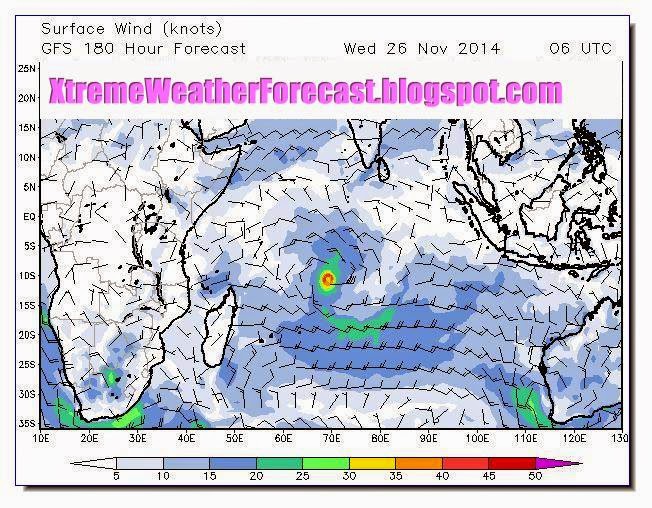
We had predicted another cyclone to form; this one in the south Indian ocean. But it seems that one too will be still born. It will remain a depression. The name "Bansi" is not going to be used for some more time. One wonders why the storms in the southern Indian ocean are so weak, while the northern part of the ocean throws up monsters like Phailin, Hudhud and the infamous cyclone of 1999 in the Bay of Bengal.
-----------------------------
UPDATE: NOVEMBER 30, 2014
Both the tropical storms "2S" and "Sinlaku" are dissipating presently but two more storms are on the horizon. Cyclone Bansi will form in the South Indian Ocean on December 3-4, 2014 WSW of Indonesia and move towards Australia. Typhoon "Hagupit" will be born a couple of thousand kms east of Philippines deep in the Pacific.
Bansi will reach cyclone status on December 4. It will turn into a powerful storm but will move towards Australia and start disintegrating by December 5, 2014. Away from any inhabited land it will go largely unnoticed barring by the ships that traverse the Indian ocean.
Hagupit is another super typhoon in the making. It will become a tropical storm on December 3, 2014 and start intensifying into something mammoth. Present indications are it will not move into Philippines but curve towards Japan on December 7, 2014.