Satellite image of Neoguri taken today (July 7, 2014) at 9:00 AM GMT.
Infra-red satellite image of super typhoon Neoguri taken today at 4:53 AM GMT (July 7, 2014)
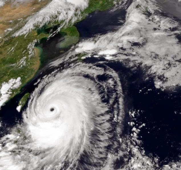
As we write this the first super cyclone of the year is about to hit the Japanese island of Okinawa. Neoguri is a monster, make no mistake about that. JTWC warns that it could whip up winds of 175 knots (The KTS in the map above is knots not kph. 1 knot=1.825 kph).That means winds of a devastating 325 kph. Japan is in for trouble.
Nasa satellite image of Neoguri as it moves past Taiwan.


No comments:
Post a Comment